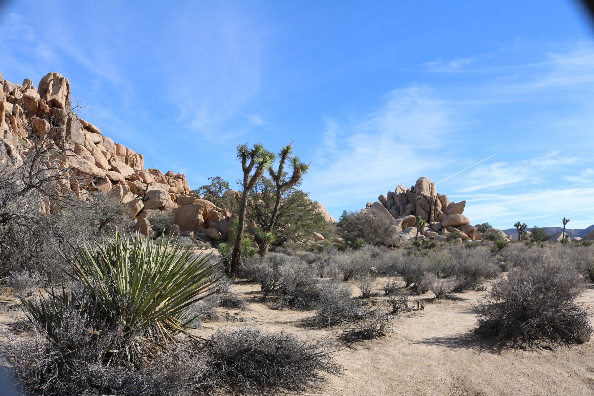
Hidden Valley Nature Loop is a fun place and usually my first stop when visiting Joshua Tree National Park.
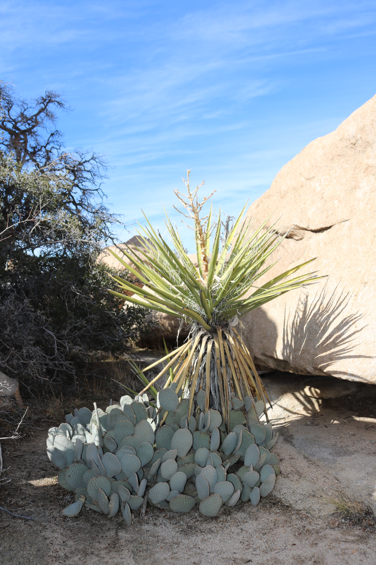
The valley loop is home to several of the native plants that are home to park. Piñon Pine, Yucca, Beaver Tail Cactus and of course, Joshua Trees can be found along the trail.
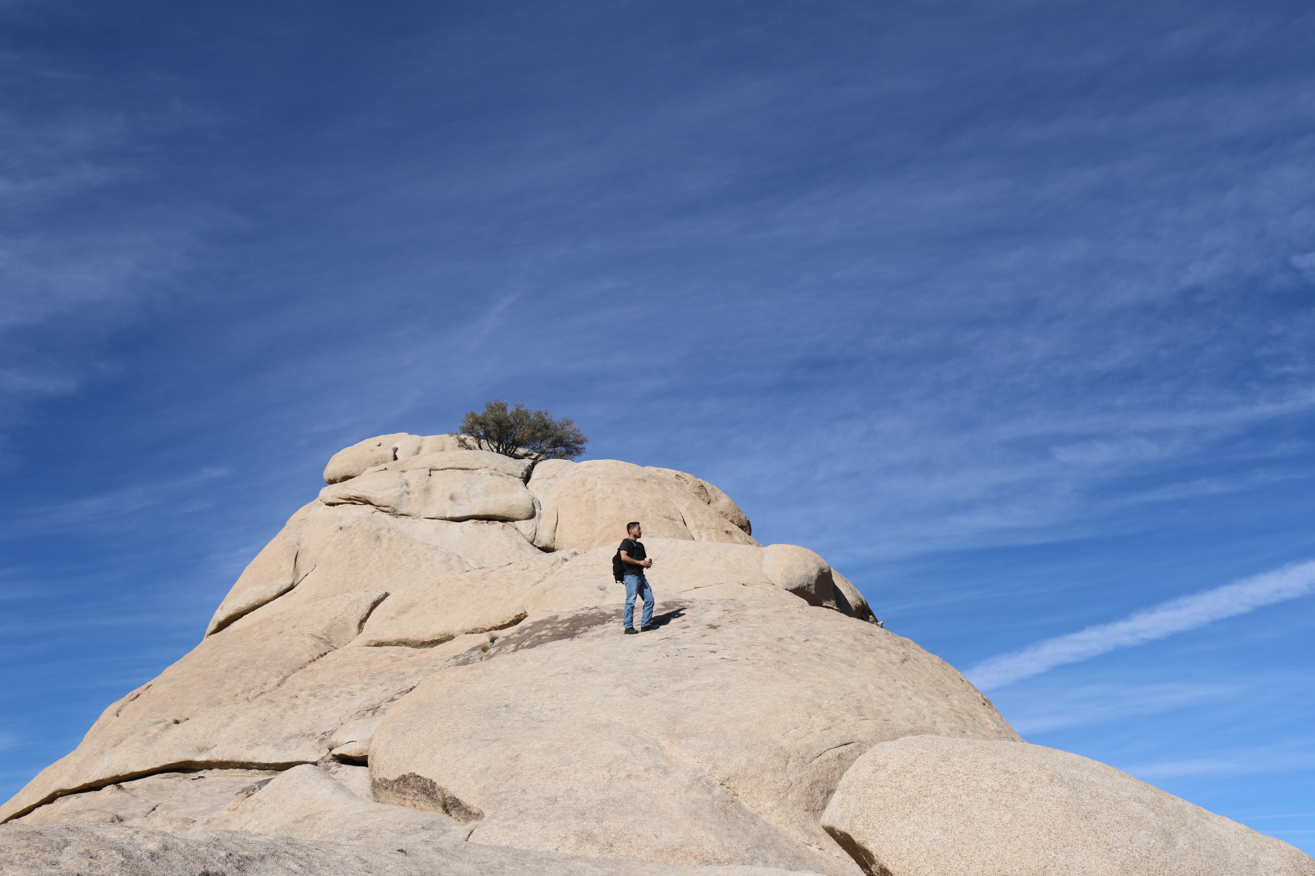
The loop is just over a mile long but you can spend the whole day here scrambling around and exploring side trails.
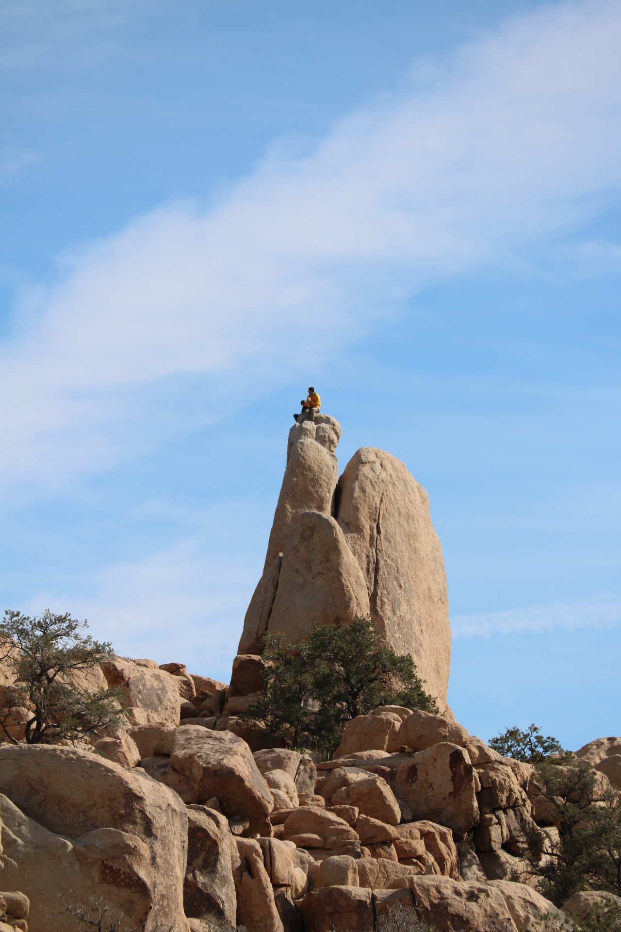
The valley loop is also popular with climbers. While on your hike take a moment to stop and scan the boulders you’ll most definitely spot someone taking in the views.
Elephant Rock is probably one of the most awesome rock formations I’ve seen. It’s definitely one of the best in this park! Arches are cool.. but come on, it’s an Elephant!
Beautiful Hagador Canyon in the Santa Ana Mountains. This beautiful canyon really caught me by surprise. I had never hiked in the Eastern part of the range so I didn’t really know what to expect. Well…. IT WAS AWESOME!
The hike it’s self is is just under 4 miles roundtrip but with neighboring Tin Mine Canyon just around the way you could easily do both hikes in one day.
Hagador Canyon
The steepness of the eastern slopes of the range makes for awesome views.
The canyon is well shaded and the beautiful singletrack trail gives the narrow canyon a even more cozy feel.
From the parking area continue down the concrete path until the the mountains become visible. Go over the guardrails on the left and follow the unnamed trail until you reach the Hagador Canyon Trail. Look for this sign and make a left.
● 4 miles round trip – Out and back
● Less than 500 ft of gain
● Difficulty – Easy
● Shaded trail
● Family friendly
● Dog friendly
● FREE PARKING
● Poison Oak
Mobius Arch is one of many natural arches in the Alabama Hills. It is the most popular though and gets many visitors on a daily basis. The drive up Whitney Portal Road is a beautiful one. Drive slow and enjoy the views.
View of trailhead and the Sierra Nevadas
After turning down movie road you drive down a couple miles and reach the Mobius Arch Trailhead.
One of many natural arches
The area is home to 100’s of natural arches so keep your eyes open and you might spot a few.
Sierra Nevada Mountains
Mobius Arch is about halfway up the trail. Its a loop hike so start in either direction and you will run into it. Actually going counter clockwise will probably get you there a bit sooner.
Mt Whitney
Here we have Mt. Whitney ( 14,508 ft), the highest point in the lower 48, framed by the Mobius arch.
This beautiful,and I do mean beautiful hike starts after a bumpy 2 mile drive on Darwin Falls Rd. The marked trailhead holds about 10 cars.
Darwin Wash
From the parking lot continue past the information board and up the wash. The dry creek bed is littered with debris from past flash floods so check the weather before entering the wash.
Entering the oasis
About three quarters of a mile up the wash the green begins to appear and the riparian habitat reveals itself. The canyon narrows and soon enough you’ll find yourself crossing creeks and jumping boulders.
Riparian habitat in the desert, Darwin Creek
Darwin Creek reveals more of itself the closer you get and the sound of the flowing creek becomes louder
Darwin Creek
Small cascades lure you closer and gushing sounds of lower Darwin Falls motivate you to pick up the pace. After some creek crossings and a little bush whacking, you arrive to one of, if not the best features in Death Valley National Park.
Beautiful Lower Darwin Falls
Beautiful Lower Darwin Falls. Upper falls and a beautiful fern gully sit above the lower falls. To access it you have to climb up on the left of the cliff face. Use extreme caution if you decide to do this. I saw a few people heading up but didn’t go because I had my daughter with me.
● Trail difficulty – Easy
● 2 Mile out and back ● 20 ft waterfall ● Riparian habitat ● Bird watching ● Wildlife viewing
This hike is definitely a short one. The time it will take you to drive to the trailhead will far exceed the time it takes to make this roundtrip trek, but if you’re looking for a picturesque romantic spot to take that special someone look no further.
Heart Rock Waterfall
The Heart Rock Falls trail is only 1.75 miles roundtrip. This is a trail that anyone can do with only a 200 foot elevation gain.
The trail winds through the pine forest and is always within a stones throw of the creek.
Directions:
Take the 210 and exit at Waterman Avenue. Take Waterman north for about 11 miles to Highway 138. Take 138 for 2.5 miles. This road will take you through a small town and past several cabins. It’s easy to accidentally veer off of 138 so you want to keep checking street signs along the way. You will see a sign on the left for Camp Seely. Make a left into the camp and follow the road to the left and across the small creek. You can park in the small dirt lot directly across from the camp playground. The trailhead is to the left of the lot. You will need an Adventure Pass.
Yesterday, the 17th of October. A couple of friends and I were lucky enough to join the members of OC Parks and IRC on a docent led hike to the Red Rocks of Black Star Canyon. They were extremely friendly and very knowledgeable of the land, plants, and history of the canyon.
The park is currently only open for guided tours on select days but will eventually open to the public and will be known as Black Star Canyon Wilderness Park and will span about 2,000 acres.
Due to time limitations we were not able to view the whole park. The hike was scheduled for 2 hours and with 4 stops along the way we only made it about a mile or so into the canyon.
The park itself is plentiful with plant life and signs of wildlife as well. There is also a Golden Eagles Nest on the cliff side, though there was no sign of the eagle, it was still a sight to see.
I look forward to the opening of this wilderness park and I want to thank OC Parks and IRC for their very informative tour.
For information on guided tours and other activities visit IRC website for details.
We decided to take a short Monday morning hike out to the red rocks of Whiting Ranch. To our surprise we came across a number of deer. I was able to catch a couple with my phone’s video camera.
The Borrego Trail when combined with the Red Rocks Trail is a 5 mile hike round-trip (2.5 miles in 2.5 miles out). This is a great beginners hike and a hike that even the youngest family member can participate in.
Eaton Canyon is one of those places that is tucked away right beneath our noses. It is literally a few blocks from the freeway. Making it a great place for a quick day hike.
Eaton Canyon Waterfall is located in Pasadena, Ca and is a beautiful sight! Much like other waterfalls located in the San Gabriel Mountains. The waterfall itself is 50 ft with a large pool at its base. It is at the end of a 1.5 mile trail that begins at the parking lot of the Eaton Canyon Nature Center. Parking here is free of charge.
With a total Elevation gain of about 400 ft in 1.5 miles this hike is good for people of all ages. The first mile is on a dirt trail until you reach the Mt Wilson Toll Bridge. As u pass under the bridge you will soon notice the creek on the left hand side, there are a couple small pools here, this a great spot to take some pictures and enjoy the scenery.
The remainder .5 miles is in a narrow part of the canyon and consists of creek crossings and some rock scrambling so be careful on this last part.
There are a few side trails that branch off from the main trail. STAY ON THE MAIN TRAIL!!! Eaton Canyon has been the subject of multiple deaths this year News Link. the easiest way to get lost or seriously injured is by venturing off the main trail.
This is a popular hike so it does get crowded. Get there early if possible.
• 50 ft Waterfall
• 3 mile round trip
• Difficulty- Easy
• Free Parking
• 400 ft elevation gain Click here for directions