• Easy Hikes
  • Moderate Hikes
  • Strenuous Hikes
  • Waterfalls
  • Outdoors
  • Distance hikes
  • Peaks
  • Caves
  • News
  • The 10 Essentials
  • Directions to our Favorite Trails

Your Favorite Hiker

~ Exploring SoCal and beyond!

Your Favorite Hiker

Tag Archives: outdoors

Griffith Peak

22 Sunday Jan 2017

Posted by Alex G in Distance hikes, Moderate Hikes, Outdoors, Peaks, Strenuous Hikes

≈ Leave a comment

Tags

Bristlecone Pine trees, Hiking, Las Vegas, mountains, nature, outdoors, Southern Nevada, spring mountains

Griffith Peak is located in the Spring Mountains.  It is the 3rd highest peak in Southern Nevada ( 11,064 ft)

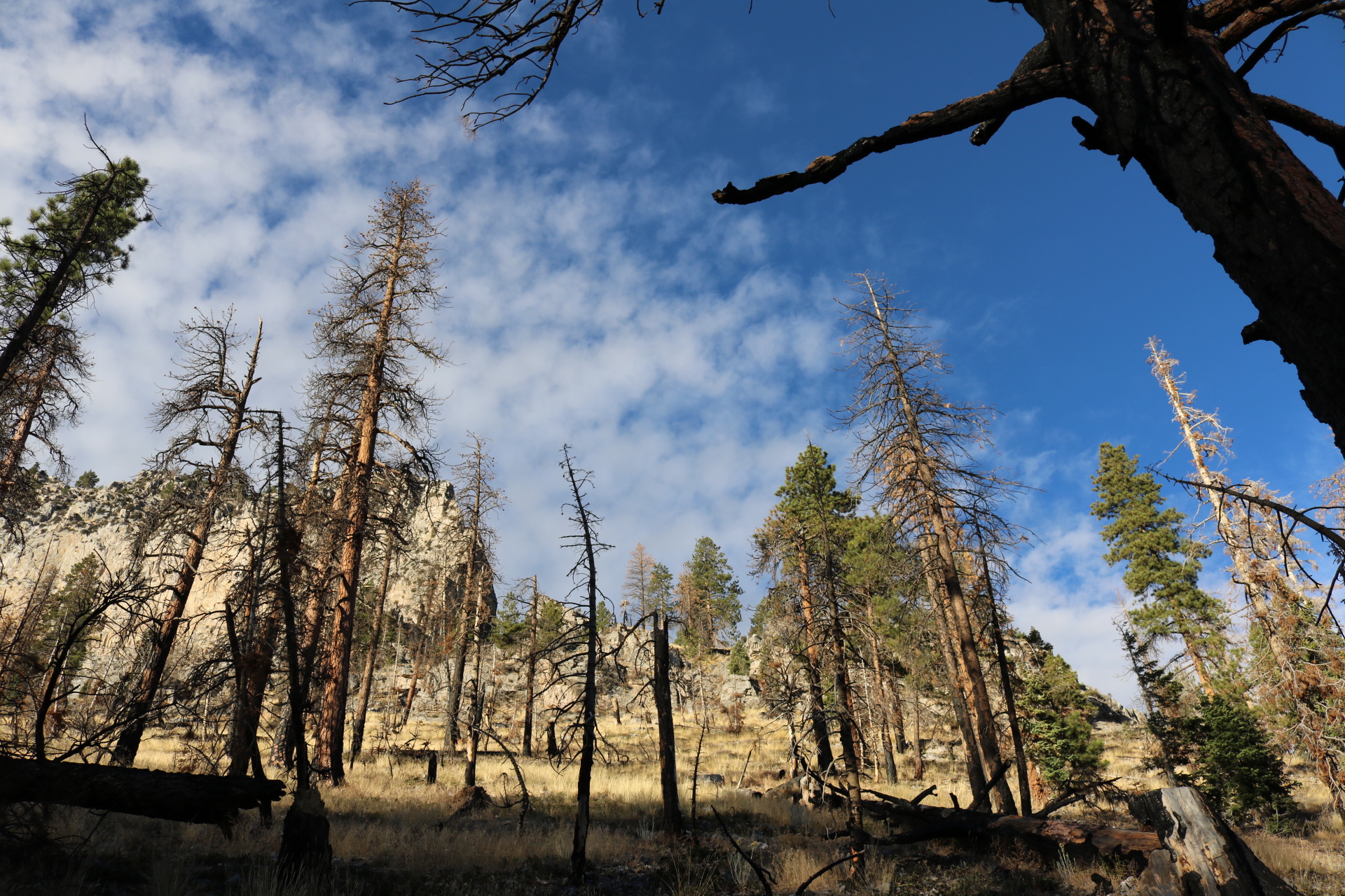
The trail passes through the old burn area of the Carpenter1 fire. You’ll the the scars along the way. Towering Ponderosa Pines dominate this first section of trail.

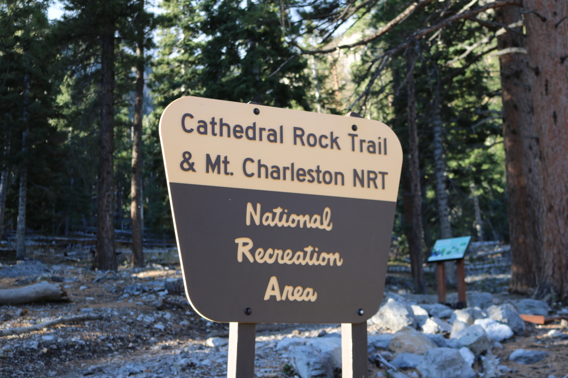
Junctions are well marked follow signs for Griffith Peak. 

As you climb up the canyon the trail gets a lot steeper but the magnificent views outweigh the pain. Just keep moving. You’re getting closer!

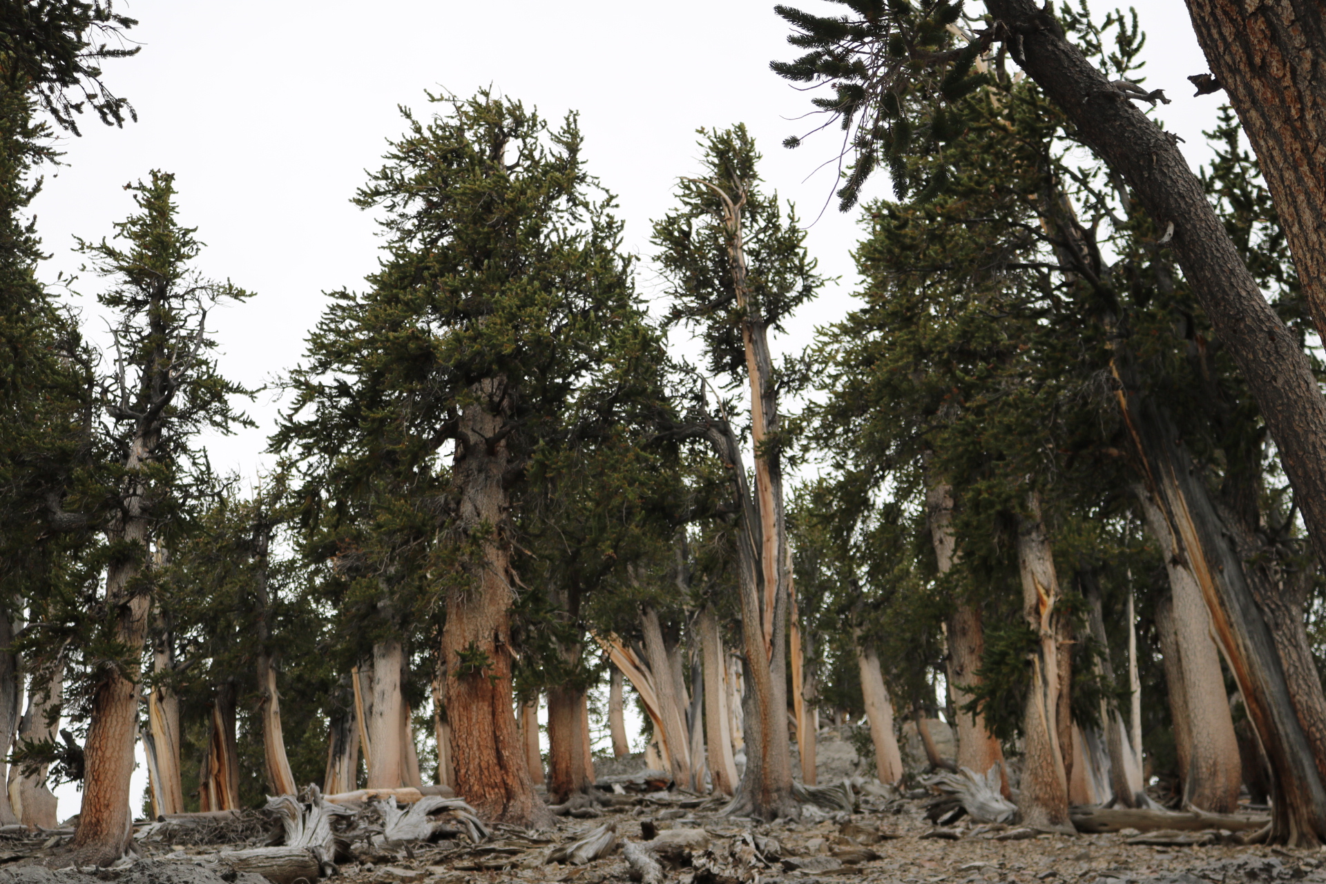
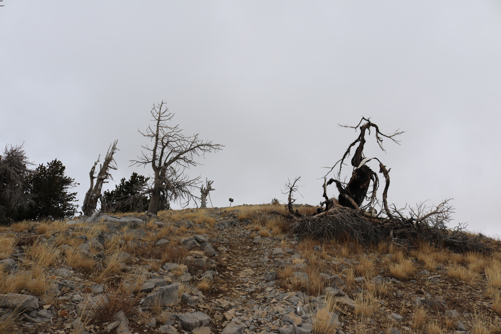
Once you climb out of canyon you hit a series of switchbacks through a ancient Bristlecone Pine Forest. 

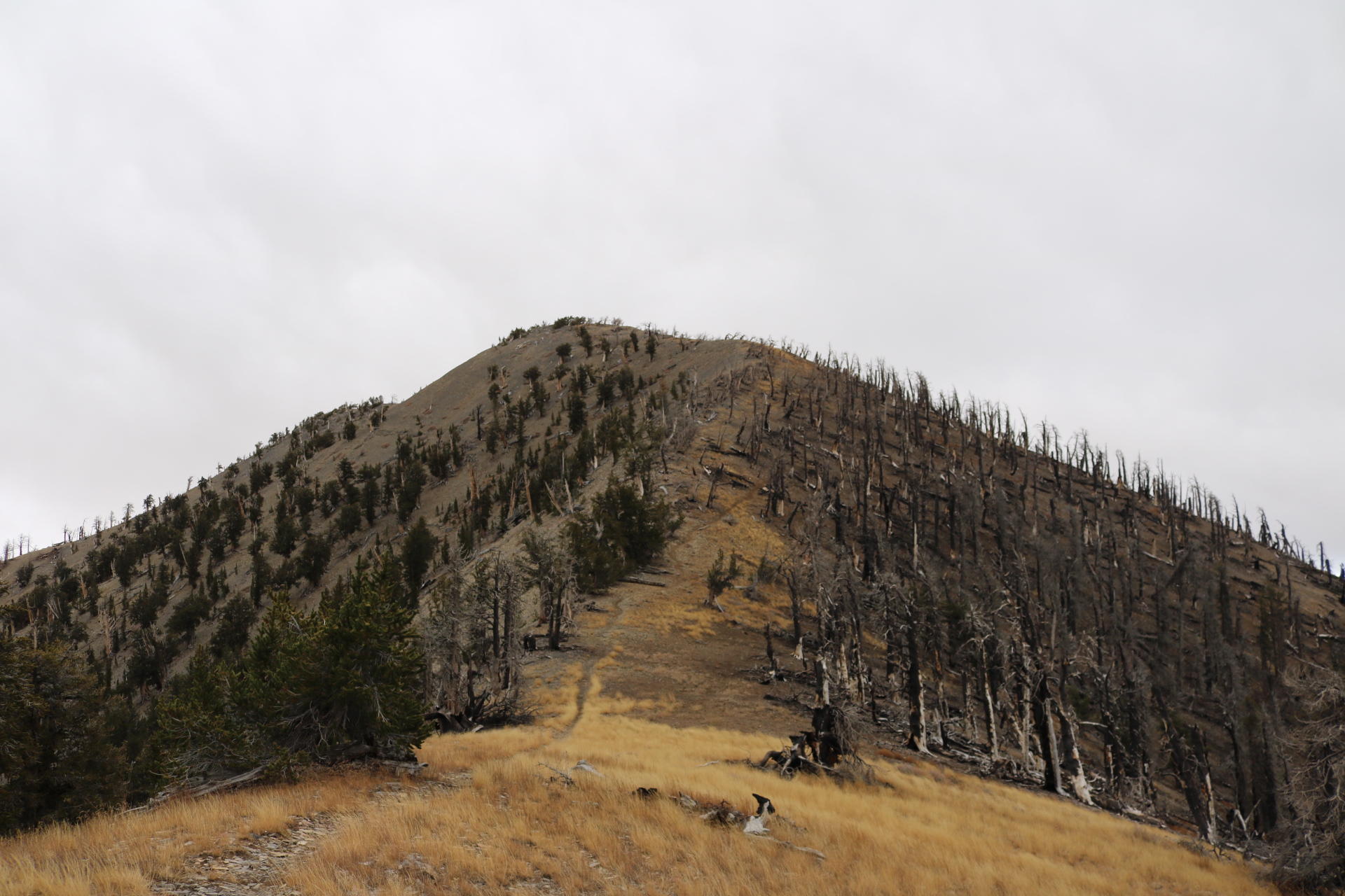
After the last switchback you are left with your first view of Griffith Peak. Proceed on over to the saddle and make a left. 

Push for the peak on this last stretch and you’ll be rewarded with amazing views !

Views from the peak on a cloudy cloudy day!

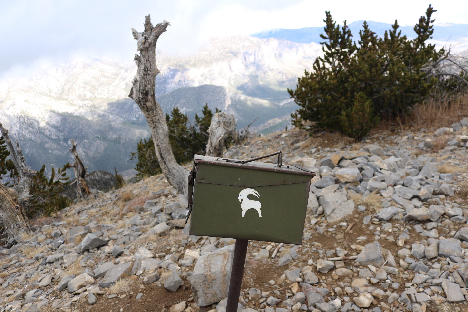
Summit register! Goat worth hike for sure! Make sure to sign in or it never happened! 🙂

  • Difficulty – Strenuous 
  • 3300 ft gain
  • 10 miles
  • Out and back
  • Amazing views
  • Season – Late Spring to Fall

LINK TO TRAILHEAD

LINK TO GPS TRACK

LINK TO PHOTO ALBUM

Like this:

Like Loading...

Hidden Valley Loop

19 Thursday Jan 2017

Posted by Alex G in Cave, Easy Hikes, Outdoors, The 10 Essentials

≈ Leave a comment

Tags

california, desert, family hikes, Hiking, Joshua Tree, national park, outdoors

Hidden Valley Nature Loop is a fun place and usually my first stop when visiting Joshua Tree National Park.

The valley loop is home to several of the native plants that are home to park. Piñon Pine, Yucca, Beaver Tail Cactus and of course, Joshua Trees can be found along the trail. 

The loop is just over a mile long but you can spend the whole day here scrambling around and exploring side trails. 

The valley loop is also popular with climbers. While on your hike take a moment to stop and scan the boulders you’ll most definitely spot someone taking in the views. 

CLICK FOR GOOGLE MAPS LINK TO TRAILHEAD

  • Difficulty – Easy
  • Season – Winter, Spring, Late Fall
  • Family friendly 
  • No dogs allowed
  • No shade ( it’s the desert)
  • Bring plenty of water

Like this:

Like Loading...

SAN MATEO PEAK

29 Tuesday Mar 2016

Posted by Alex G in Moderate Hikes, Peaks, Strenuous Hikes

≈ Leave a comment

Tags

california, cleveland national forest, Hiking, outdoors, san Mateo Peak, santa ana mountains

image

San Mateo Peak is located in the San Mateo Canyon Wilderness of the Cleveland National Forest, in the Santa Ana Mountains. At 3,591 ft it is the highest point in the SMC Wilderness.

image

Views from the peak to the east are amazing. Lake Elsinore is pictured here.
Also  visible are the San Gabriel, San Bernardino and San Jacinto Mountains.

image

The trailhead for this peak is located off of the S. Main Divide Rd at the MORGAN TRAILHEAD

Take the trail down and make a left at the first junction, about a 1/4 mile in.  Follow this trail and keep right at the second junction until you reach a cairn and sign that reads San Mateo Peak. Make a right here.

image

From here the trail climbs steeply for a good 1/2 miles. It eventually levels off again but still has some steep points.

It’s about 2.3 miles to the summit from the trailhead. Trail starts off easy for the first mile then steeply climbs of the east face of the mountain.

image

Thank you to Maria and Angie for joining me on this trek.

▪Difficulty – Easy/Moderate/Strenuous
▪5 Miles round trip/  out and back
▪Bring a hat and sunscreen
▪Forest adventure pass for parking

Like this:

Like Loading...

MT. CHARLESTON PEAK – NEVADA

22 Tuesday Dec 2015

Posted by Alex G in Distance hikes, Outdoors, Peaks, Strenuous Hikes

≈ 1 Comment

Tags

Hiking, mt. Charleston, nature, Nevada, north loop trail, outdoors, peaks, spring mountains, trail canyon

image

image

image

Mt. Charleston Peak  was a pretty awesome hike! At 11,918 ft it is the tallest mountain in Southern Nevada. The views from the top are some of the best! Vegas amd Death Valley are visible from the peak. It is said that on a clear day the Sierra Nevada are visible from the peak.

It had been on my list for a few years and on Labor Day I finally checked it of my list ✔

image

image

Had the pleasure of bagging this peak with my good friend and fellow hiker Neal. He’s the one who got me into bagging peaks so it was only fitting hat he joined me on this trek.

image

image

image

We started close to 8 am and took the Trail Canyon Trail up to the North Loop Trail to the peak.

  The hike itself is one of the most beautiful hikes I’ve done. The landscape is painted with Quaking Aspen and towering pines peirce the sky. In the upper reaches of the Limestone cliffs Bristlcone Pines dominate the mountain.

image

image

image

● 17 miles out and back
● 8 -10 hours
● Difficulty – Very Strenuous
● Elevation Gain – 4,500 ft

Click for Google Maps link to trailhead

Link to full photo album

36.272185 -115.695019

Like this:

Like Loading...

AVALANCHE on MOUNT EVEREST

27 Monday Apr 2015

Posted by Alex G in News, Peaks

≈ Leave a comment

Tags

avalanche, earthquake, everest, hiking mountains, Himalaya, Mount Everest, mountaineering, mountaineers, mt. Everest, nepal, outdoors

The huge 7.8 quake that hit Nepal triggered several avalanches this one was at the Mt. Everest base camp.

18 persons were killed and hundreds more left stranded on the mountain.

It is the deadliest accident on the mountain.

Like this:

Like Loading...

LOWER DARWIN FALLS – DEATH VALLEY NATIONAL PARK

26 Sunday Apr 2015

Posted by Alex G in Easy Hikes, Outdoors, Waterfalls

≈ 2 Comments

Tags

Creek, death valley national park, desert, DVNP, easy hike, Hiking, mojave desert, national park, outdoors, waterfall

image

Darwin Falls Rd.

This beautiful,and I do mean beautiful  hike starts after a bumpy 2 mile drive on Darwin Falls Rd. The marked trailhead holds about 10 cars.

image

Darwin Wash

From the parking lot continue past the information board and up the wash. The dry creek bed is littered with debris  from past flash floods so check the weather before  entering the wash. 

image

Entering the oasis

About three quarters of a mile up the wash the green begins to appear and the riparian habitat  reveals itself. The canyon narrows and soon enough you’ll  find yourself crossing creeks and jumping boulders.

image

Riparian habitat in the desert, Darwin Creek

Darwin Creek reveals more of  itself the closer you get and the sound of the flowing creek becomes louder

image

Darwin Creek

Small cascades lure you closer and gushing sounds of lower Darwin Falls motivate you to pick up the pace. After some creek crossings and a little bush whacking, you arrive to one of, if not  the best features in Death Valley National  Park.

image

Beautiful Lower Darwin Falls

Beautiful  Lower Darwin Falls. Upper falls and a beautiful fern gully sit above the lower falls. To access it you have to climb up on the left of the cliff face. Use extreme  caution if you decide to do this. I saw a few people  heading up but didn’t go because  I had my daughter with me.

● Trail difficulty – Easy
● 2 Mile out and back
● 20 ft waterfall
● Riparian habitat
● Bird watching
● Wildlife viewing

Click for directions
Darwin Falls Trailhead

Like this:

Like Loading...

LOS PINOS PEAK VIA TRABUCO CANYON

19 Friday Dec 2014

Posted by Alex G in Distance hikes, Outdoors, Peaks, Strenuous Hikes

≈ Leave a comment

Tags

california, cleveland national forest, Hiking, Holy jim, Main Divide road, nature, orange county, outdoors, santa ana mountains, Trabuco canyon

This is a 13 mile hike that starts in beautiful Trabuco Canyon. The trailhead for this hike is located at the end of Trabuco Creek Rd. This is a bumpy ride on an  unmaintained dirt road. So a 4×4 or a high clearance vehicle is recommended.

image

The first 2 miles on the West Horsethief Trail are mostly shaded and follow the creek.

image

View of Trabuco Canyon

After the first 2 miles you start to climb up the walls of Trabuco Canyon and the views begin to open up. This steep section is the toughest part of the hike. After 2 miles you reach the Main Divide Rd.

image

The Main Divide  Rd. offers some great views into Riverside County. Lake Elsinore is pictured above also visible from the road are San Jacinto and the San Bernardino Mountains. 

image

Los Pinos Ridge Trail

After 3 miles on the Rd you reach the Los Pinos Trail. This ridge line is one of my favorites in the range. The views from the ridge are amazing!

image

View from Los Pinos Peak

Once on the peak, enjoy the marvelous views an retrace your steps.  Go back to the main divide/los pinos junction and make a left to take the Trabuco Canyon trail. 

This shady downhill trail is my favorite!  It’s a bit rocky but the views are so worth it!

image

Trabuco Canyon Trail

image

This Trai will take you back to West Horsethief trail. Then return the way you came. This lollipop loop is one of the best in So Cal!

Trail route:
West Horsethief to Main Divide, Main Divide to Los Pinos Trail, Los Pinos  back down to Main Divide/Trabuco Canyon/ Los Pinos trail Junction,  Take Trabuco Canyon trail back to West Horsethief and back to parking lot.

● 13 mile Lollipop Loop
● 4th highest peak in the range.
● Beautiful views
● Dog friendly trail
● approx 2,500 ft of gain
● High clearance vehicle recommended

CLICK BELOW FOR GOOGLE MAPS LINK TO PARKING AREA
West Horsethief/Trabuco Canyon Trailhead

Follow me on Instagram for more outdoor photos and info on hikes.

Like this:

Like Loading...

Bear that killed hiker in West Milford, New Jersey | abc7.com

26 Wednesday Nov 2014

Posted by Alex G in News

≈ Leave a comment

Tags

bear, black bears, Hiking, nature, New Jersey, outdoors

image

This is a sad story and a great reminder not to run when you see a bear!

http://abc7.com/news/hiker-takes-pictures-of-bear-before-being-killed-by-bear/412640/

Like this:

Like Loading...

BRISTLECONE TRAIL – MT CHARLESTON

28 Wednesday May 2014

Posted by Alex G in Moderate Hikes, Outdoors

≈ Leave a comment

Tags

bristlecone trail., Hiking, Lee canyon, mountains, mt. Charleston, Nevada, outdoors

image

The Sisters and Lee Canyon

The Bristlecone Trail is located at the end of Lee Canyon in the Mt Charleston area of the Spring Mountains in Southern Nevada. The trail is around 5 miles long and can be done as a loop (with less than mile section of road.) Making it closer to 6 miles.

image

  There are 2 trailheads Upper Bristlecone and Lower Bristlecone. The lower trail takes you up an old road and is pretty much exposed for 3 miles until you get to the Bonanza Trail Junction.  Continue on the Bristlecone trail for the remaining 2 mile hike downhill to the Upper Bristlecone Trailhead.

image

Quaking Aspen

The hike can be done in any direction.  If you are starting early I would suggest doing it from the lower section first to get the exposed part out of the way.

image

image

Upper Bristlecone Trailhead

image

Quaking Aspen

Bristlecone pines, Ponderosa pines and Quaking Aspen can be found along the trail.

Click for Google maps to trailhead

Follow me on Instagram for more outdoor photos and trail info.

Like this:

Like Loading...

Mt. Baldy- Ski Hut-Devils Backbone Loop

22 Tuesday Oct 2013

Posted by Alex G in Distance hikes, Outdoors, Peaks, Strenuous Hikes

≈ Leave a comment

Tags

Hiking, mount baldy, mountain, my baldy, nature, outdoors, peak

image

Mt Baldy is the highest mountain in the Los Angeles area and  is a very popular hike amongst the hiking community. I’ve had the pleasure of summiting this mountain 6 times and the view is just as breathtaking as the first time.

image

Ski Hut from the trail

The Ski Hut Trail begins about .6 miles up Falls Rd passing San Antonio Falls. There used to be a sign marking the obscure trail but that has since be removed. So keep by our eyes open as this trail is easy to miss. It is on the left hand side.

The Ski Hut marks the halfway point to the summit. This is a great place to stop have a snack and if you’re lucky you might even spot some wildlife.

image

Deer grazing just below the Ski Hut

From here you will cross the Baldy Bowl, do a little boulder scrambling and then back into the pine forest to continue the ascend to the summit. 

Once at the summit if you look in a Southeastern direction you will the the Devils Backbone Trail. Views from this trail are amazing!

image

Devils Backbone viewed fromnthe Summit

image

image

Take this trail down to the Baldy Notch (Ski lifts) from there you can either take the ski lifts down (if they’re running) or take the road down which is directly behind the restaurant. The road will take you back down and pass up the waterfall and leave you back at your car.

Click here for directions to the parking lot

***BE SURE TO USE EXTREME CAUTION WHEN HIKING ON THE DEVILS BACKBONE TRAIL. I DO NOT RECOMMEND HIKING THIS TRAIL AFTER SNOW FALL. PEOPLE HAVE DIED ON THIS TRAIL BEFORE ***

• 11.3 MILE LOOP
• HIKING POLES RECOMMENDED
• AMAZING VIEWS
• 3‚900 FT OF GAIN
• 7-9 HRS TO COMPLETE
• ADVENTURE PASS IS REQUIRED

Like this:

Like Loading...
← Older posts

Blog Stats

  • 118,832 views

Top Posts & Pages

  • AGUA CHINON TO THE SINKS
  • Ladder Canyon (Mecca Hills, CA)
  • BLACK MOUNTAIN -HENDERSON,NV
  • The Wally Waldron Tree
  • Mt. Baldy- Ski Hut-Devils Backbone Loop
  • BLACK STAR CANYON INDIAN VILLAGE

Enter your email address to follow this blog and receive notifications of new posts by email.

Join 401 other subscribers

Advertisement

Archive

Create a free website or blog at WordPress.com.

Privacy & Cookies: This site uses cookies. By continuing to use this website, you agree to their use.
To find out more, including how to control cookies, see here: Cookie Policy
  • Follow Following
    • Your Favorite Hiker
    • Join 61 other followers
    • Already have a WordPress.com account? Log in now.
    • Your Favorite Hiker
    • Customize
    • Follow Following
    • Sign up
    • Log in
    • Report this content
    • View site in Reader
    • Manage subscriptions
    • Collapse this bar
 

Loading Comments...
 

    %d bloggers like this: