• Easy Hikes
  • Moderate Hikes
  • Strenuous Hikes
  • Waterfalls
  • Outdoors
  • Distance hikes
  • Peaks
  • Caves
  • News
  • The 10 Essentials
  • Directions to our Favorite Trails

Your Favorite Hiker

~ Exploring SoCal and beyond!

Your Favorite Hiker

Tag Archives: canyon

Update: Missing Eaton Canyon Hikers Found

05 Friday Apr 2013

Posted by octrailhikers in News

≈ 1 Comment

Tags

canyon, Eaton, hikers, missing, mountains, rescue, San Gabriel, sheriffs department

The five hikers that were reported missing on Friday morning have been found uninjured. The group apparently failed to inform anyone that they planned on camping overnight instead of returning home on Thursday evening.

What a waste of the Sheriff Department’s resources…

Like this:

Like Loading...

5 Hikers Lost in Eaton Canyon

05 Friday Apr 2013

Posted by octrailhikers in News

≈ 1 Comment

Tags

canyon, Eaton, hikers, Hiking, los angeles, lost, missing, mountains, San Gabriel, sheriffs, waterfall

image

Less than a month after a hiker lost their life in Eaton Canyon, a group of hikers has gone missing in the same area. The group set out at 8am Thursday morning and were expected back 8 hours later. The group was reported missing by one of the hikers’ parents Friday morning.

Eaton Canyon is located in the San Gabriel Mountains. The search for the missing hikers is being lead by the Los Angeles Sheriff’s Department. Eaton Canyon is an extremely popular hiking destination for Southern California natives, but has had more than of it’s faor share of rescues and deaths over the past few years.

Like this:

Like Loading...

BLACK STAR CANYON TO SILVERADO CANYON

01 Thursday Mar 2012

Posted by Alex G in Distance hikes, Outdoors, Peaks, Strenuous Hikes, Waterfalls

≈ 2 Comments

Tags

beeks place, Black Star Canyon, canyon, cleveland national forest, distance, doppler, hike, Hiking, long, maple springs, peak, radar, santa ana mountains, Silverdo, trail

This 20 mile hike begins at the Black Star Canyon Trailhead and ends at the Maple Springs Trailhead. We used the car shuttle system to complete this hike, meeting at the Maple Springs Trailhead, leaving a car there and carpooling to the beginning of the hike.

This is a great hike with lots of points of interest: A coal mine, school bus, historic Indian site, Beeks place, doppler radar, Pleasants Peak and amazing views are things that you will experience along the way.

The hike begins at the parking lot just past the large steel gates.This is Black Star Canyon Rd. The first 2 miles are on a wide level fire road. Along the way you will see a closed off coal mine on the right and shortly after an old abandoned tractor and an old school bus in the creek are visible on the left.

New Bridge on Black Star Cyn Rd

School bus in the creek

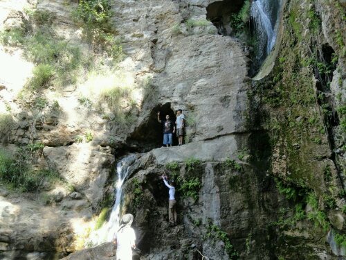
A little past the the 2 mile mark you will see a house to your right, this is Black Star Bills house. If you see him say hi and keep on walking. When you reach the large concrete cylinders make a left and continue up the road. Making a right and dropping into the creek will take you to Black Star Waterfall

The next 3 miles are a gradual climb consisting of a few switchbacks and several hundred feet of elevation gain. (aprox 800ft) for the most part this section of the trail is exposed with very little shade and hardly and trees but around the 5 mile mark you will notice a bunch of Oak Trees on the right. This is the site of the Historic Indian village. This is a wonderful place for a break and an even better place to do some exploring. There’s a large amount of grinding rocks here which indicates that there was a large group of Indians that called this place home. There is a great lookout point located in the southwest section of the site.

Entering the Historic Indian Site

Grinding Rocks

Historic Indian Site

After a quick break and a small snack we continued on to the next of many points of interest on this hike. Next up, Beeks place, which is at the 8 mile mark. Beeks place sits on the Main Divide Rd and offers amazing views of Orange County, The San Gabriel Mountains and IE.

Entering the Cleveland National Forest

Beeks Place

We continued right, passing Beeks place and headed to our next destination, The Doppler Radar which is just over 1 mile from Beeks place.

Break time at the Doppler

On our way to Pleasants Peak we stopped at Little Pleasants Peak to check out the views

view from Little Pleasants Peak

Our next stop was Pleasants Peak (4,007 ft) This peak is much like the Santiago Peak but on a smaller scale of course. 360 views are not possible because of the many communication towers that call this place home but a quick scramble up the ridge provide awesome views!

Pleasants Peak

My beautiful wife an I before leaving Pleasants Peak

Leaving Pleasants Peak

From here we still had 8 miles to go! We thought it would be all down hill from here but we were mistaken. The rest of this trek on the Main Divide consisted of rolling hills once we reached the 17 mile mark we reached the junction with Main Divide and Silverado Truck Trail. We took the Silverado Trail (straight ahead)  for the remaining 3 miles to the car. Making a left will take you to Bedford Peak.

On our way down the Silverado Trail we had amazing views of Santiago Peak as the clouds rolled in.

Santiago Peak from Silverado Trail

Happy Trails,
Alex G

RECAP:

  1. ****STAY ON WIDE FIRE ROAD THE FIRST 17 MILES****
  2. First 8 miles are on Black Star Canyon Rd
  3. Make a right at Main Divide towards Beeks Place and continue for 9 miles
  4. At 17 mile mark go straight past the brown rails and take Silverado Trail for 3 miles to Maple Springs.
  5. Once on Silverado Canyon Rd make a right towards the Maple Springs parking lot
  • 20 MILES
  • 3,400 FT ELEV. GAIN
  • HISTORIC INDIAN SITE
  • DOPPLER RADAR
  • PLEASANTS PEAK(4,007FT)
  • 8 -10 HOURS TO COMPLETE
  • >>>>NO SHADE<<<<<
  • CAR SHUTTLE

CLICK HERE FOR MAP OF HIKE

This slideshow requires JavaScript.

Like this:

Like Loading...

Stinging Nettle Beware!

28 Wednesday Dec 2011

Posted by octrailhikers in Outdoors

≈ 1 Comment

Tags

blister, canyon, Creek, Hiking, irritation, itch, itching, mountain, needle, pain, poison ivy, poison oak, poison sumac, sting, stinging nettle

image

The stinging nettle is one plant you don’t want to mess with. I’m not sure if I’m just extra sensitive to it or what, but my skin’s reaction to the stinging nettle was nearly identical to when I encountered poison oak. The only current being that I knew immediately that the nettle had stung me.r

image

The stinging nettle is covered in fine hairs. When they come in contact with your skin you will definitely feel the sting. It feels like little needles jabbing you. The hairs can easily pierce thin layers of clothing too. When these hairs break of, like tiny splinters, they inject toxins which cause itching, redness and in my case blisters.

image

I have read that most over the counter itch fighting creams can provide relief, but I guess I’m just an odd ball because nothing seems to be giving me any relief!

image

Like this:

Like Loading...

Deer Season at Whiting Ranch

26 Monday Sep 2011

Posted by octrailhikers in Easy Hikes, Outdoors

≈ Leave a comment

Tags

Borrego Trail, canyon, Creek, Deer, Hiking, Oaks, Orange County Hiking, Red Rocks, santa ana mountains, Whiting Ranch

image

We decided to take a short Monday morning hike out to the red rocks of Whiting Ranch. To our surprise we came across a number of deer. I was able to catch a couple with my phone’s video camera.

The Borrego Trail when combined with the Red Rocks Trail is a 5 mile hike round-trip (2.5 miles in 2.5 miles out). This is a great beginners hike and a hike that even the youngest family member can participate in.

Directions to Whiting Ranch (Borrego Trail)

Posted from WordPress for Android

Like this:

Like Loading...

Blackstar Canyon Waterfall

18 Thursday Aug 2011

Posted by octrailhikers in Cave, Outdoors, Strenuous Hikes, Waterfalls

≈ 1 Comment

Tags

blackstar, canyon, cave, county, Creek, Hiking, irvine, oc, orange, salamander, waterfall

image

image

image

image

     If you have grown up in OC, chances are that you have heard the stories surrounding Blackstar Canyon. These stories range from hauntings to cult sacrifices to murderous  squatters. While I’m not willing to confirm or deny the validity of any of these tales, I can tell you that there is indeed a pretty spectacular waterfall hidden here.
     Most hikers that venture into Blackstar Canyon never make it quite far enough into the canyon to find the waterfall trail. Those that do make it in are likely to pass right by the shrub covered creek entrance. From the parking area the creek entrance is 2.5 miles along a relatively flat fire road, and you can find it as long as you know what to look for. You will easily spot a couple of large concrete tubes at the point where the trail begins to climb. Directly to the right of these cylinders you will spot a small clearance in the brush that is bordering the trail. This is the entrance down into the creek.
     The creek  portion of the hike provides some pretty challenging boulder climbing which is obviously most difficult in the winter and spring months due to the rain. The trek through the creek is an additional 2.5 miles, but plan on it feeling more like 4 miles when you factor in all of the climbing. Be sure to pack plenty of water and some light snacks. A first aid kit would also be a wise choice. This trail is covered in poison oak and I have witnessed a pretty nasty cut resulting in 14 stitches as well as someone taking a tumble from the cave that is alongside the waterfall.
     This is one of the more challenging trails that I have experienced in OC, but I would say that the payoff is well worth it. The Blackstar Canyon Waterfall is a spectacular site especially in the rainy season, and it is still very impressive in the dry season when the water is but a trickle. When you first lay eyes upon it I’m sure you’ll be just as surprised as I was that such a thing exists right in our own backyard.

-FPMiv
    

Posted from WordPress for Android

Like this:

Like Loading...

Blog Stats

  • 119,167 views

Top Posts & Pages

  • BLACK STAR CANYON INDIAN VILLAGE
  • HAGADOR CANYON
  • HARDING CANYON WATERFALL
  • LIMESTONE CANYON LOOP

Enter your email address to follow this blog and receive notifications of new posts by email.

Join 401 other subscribers

Advertisement

Archive

Create a free website or blog at WordPress.com.

Privacy & Cookies: This site uses cookies. By continuing to use this website, you agree to their use.
To find out more, including how to control cookies, see here: Cookie Policy
  • Follow Following
    • Your Favorite Hiker
    • Join 61 other followers
    • Already have a WordPress.com account? Log in now.
    • Your Favorite Hiker
    • Customize
    • Follow Following
    • Sign up
    • Log in
    • Report this content
    • View site in Reader
    • Manage subscriptions
    • Collapse this bar
 

Loading Comments...
 

    %d bloggers like this: