• Easy Hikes
  • Moderate Hikes
  • Strenuous Hikes
  • Waterfalls
  • Outdoors
  • Distance hikes
  • Peaks
  • Caves
  • News
  • The 10 Essentials
  • Directions to our Favorite Trails

Your Favorite Hiker

~ Exploring SoCal and beyond!

Your Favorite Hiker

Category Archives: Moderate Hikes

Griffith Peak

22 Sunday Jan 2017

Posted by Alex G in Distance hikes, Moderate Hikes, Outdoors, Peaks, Strenuous Hikes

≈ Leave a comment

Tags

Bristlecone Pine trees, Hiking, Las Vegas, mountains, nature, outdoors, Southern Nevada, spring mountains

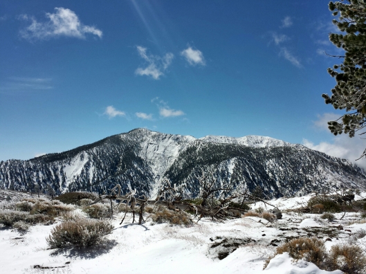
Griffith Peak is located in the Spring Mountains.  It is the 3rd highest peak in Southern Nevada ( 11,064 ft)

The trail passes through the old burn area of the Carpenter1 fire. You’ll the the scars along the way. Towering Ponderosa Pines dominate this first section of trail.

Junctions are well marked follow signs for Griffith Peak. 

As you climb up the canyon the trail gets a lot steeper but the magnificent views outweigh the pain. Just keep moving. You’re getting closer!

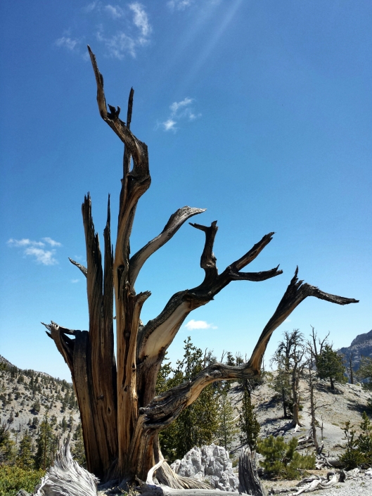
Once you climb out of canyon you hit a series of switchbacks through a ancient Bristlecone Pine Forest. 

After the last switchback you are left with your first view of Griffith Peak. Proceed on over to the saddle and make a left. 

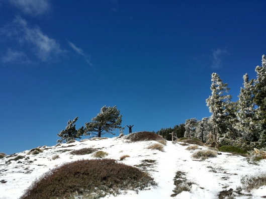
Push for the peak on this last stretch and you’ll be rewarded with amazing views !

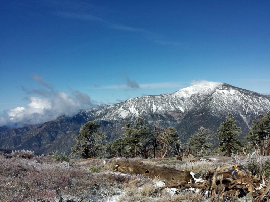
Views from the peak on a cloudy cloudy day!

Summit register! Goat worth hike for sure! Make sure to sign in or it never happened! 🙂

  • Difficulty – Strenuous 
  • 3300 ft gain
  • 10 miles
  • Out and back
  • Amazing views
  • Season – Late Spring to Fall

LINK TO TRAILHEAD

LINK TO GPS TRACK

LINK TO PHOTO ALBUM

Like this:

Like Loading...

SAN MATEO PEAK

29 Tuesday Mar 2016

Posted by Alex G in Moderate Hikes, Peaks, Strenuous Hikes

≈ Leave a comment

Tags

california, cleveland national forest, Hiking, outdoors, san Mateo Peak, santa ana mountains

image

San Mateo Peak is located in the San Mateo Canyon Wilderness of the Cleveland National Forest, in the Santa Ana Mountains. At 3,591 ft it is the highest point in the SMC Wilderness.

image

Views from the peak to the east are amazing. Lake Elsinore is pictured here.
Also  visible are the San Gabriel, San Bernardino and San Jacinto Mountains.

image

The trailhead for this peak is located off of the S. Main Divide Rd at the MORGAN TRAILHEAD

Take the trail down and make a left at the first junction, about a 1/4 mile in.  Follow this trail and keep right at the second junction until you reach a cairn and sign that reads San Mateo Peak. Make a right here.

image

From here the trail climbs steeply for a good 1/2 miles. It eventually levels off again but still has some steep points.

It’s about 2.3 miles to the summit from the trailhead. Trail starts off easy for the first mile then steeply climbs of the east face of the mountain.

image

Thank you to Maria and Angie for joining me on this trek.

▪Difficulty – Easy/Moderate/Strenuous
▪5 Miles round trip/  out and back
▪Bring a hat and sunscreen
▪Forest adventure pass for parking

Like this:

Like Loading...

BLUE RIDGE TRAIL

31 Saturday May 2014

Posted by Alex G in Moderate Hikes, Outdoors, Strenuous Hikes

≈ 1 Comment

Blue Ridge trail is a 2 mile out and back trail in the unincorporated town of Big Pines in California.  It borders the city of Wrightwood, Ca.

image

The trailhead is just east of the parking area next to the restrooms.  Look for the trail sign and start you trek through a pine and oak covered trail.

image

The trail takes you up to The blue Ridge Campground.  You can turn around here for a 4 mile hike or you can continue past the Campground and to the left and pick up the PCT. From here you you continue about 2.5 – 3  miles and you will end up on the exposed part of Blue Ridge and be reward with excellent views.

image

Pine Mountain (left) and Mt Baldy(rt)

image

A happy hiker on the Blue Ridge

Once you hit Guffy Campground you can turn around and take the road back for a change of scenery back to the Blue Ridge Campground or you can go back via the PCT to the Blue Ridge CG. This will make it a 10 mile hike.

image

View of Mojave Desert

image

Mt Baden Powell viewed from Blue Ridge

● 4 -10 mile hike
● Beautiful Views
● Dog friendly
●Mostly shaded except on Road
   bring sunscreen and a hat.

Click here for directions to trailhead.

Follow me on Instagram for more outdoor photos and trail info.

Like this:

Like Loading...

BRISTLECONE TRAIL – MT CHARLESTON

28 Wednesday May 2014

Posted by Alex G in Moderate Hikes, Outdoors

≈ Leave a comment

Tags

bristlecone trail., Hiking, Lee canyon, mountains, mt. Charleston, Nevada, outdoors

image

The Sisters and Lee Canyon

The Bristlecone Trail is located at the end of Lee Canyon in the Mt Charleston area of the Spring Mountains in Southern Nevada. The trail is around 5 miles long and can be done as a loop (with less than mile section of road.) Making it closer to 6 miles.

image

  There are 2 trailheads Upper Bristlecone and Lower Bristlecone. The lower trail takes you up an old road and is pretty much exposed for 3 miles until you get to the Bonanza Trail Junction.  Continue on the Bristlecone trail for the remaining 2 mile hike downhill to the Upper Bristlecone Trailhead.

image

Quaking Aspen

The hike can be done in any direction.  If you are starting early I would suggest doing it from the lower section first to get the exposed part out of the way.

image

image

Upper Bristlecone Trailhead

image

Quaking Aspen

Bristlecone pines, Ponderosa pines and Quaking Aspen can be found along the trail.

Click for Google maps to trailhead

Follow me on Instagram for more outdoor photos and trail info.

Like this:

Like Loading...

Gallery

Baker Canyon Night Hike with Google Glass

24 Monday Jun 2013

Posted by octrailhikers in Moderate Hikes

≈ Leave a comment

Tags

Android, Baker Canyon, blackstar canyon, Google Glass, Hiking, orange county, santiago canyon, ThroughGlass

This gallery contains 5 photos.

The “Super Moon” hike didn’t pan out the way I had hoped thanks to the clouds, but the hike was …

Continue reading →

Image

Holy Jim – April 21, 2013

21 Sunday Apr 2013

Tags

Creek, hike, Holy jim, santa ana mountains, Santiago creek, Trabuco canyon, waterfall

image

The waterfall is still running….weakly, but still running.

Click for info on getting to Holy Jim Waterfall

Like this:

Like Loading...

Posted by octrailhikers | Filed under Moderate Hikes, Waterfalls

≈ Leave a comment

BLACK MOUNTAIN -HENDERSON,NV

20 Tuesday Mar 2012

Posted by Alex G in Moderate Hikes, Outdoors, Peaks, Strenuous Hikes

≈ 2 Comments

Tags

Black, Henderson, Hiking, Las Vegas, mountain, Nevada, outdoors, peak

image

Trailhead

Black Mountain is located just 30 minutes from the Las Vegas strip and at just under 7 miles this hike offers a great workout that can be completed in just a few hours, leaving you plenty of time left to enjoy the nightlife of Vegas.

This is a beautiful place to hike. The landscape is like nothing I’ve seen before. The mountain itself is volcanic in origin and that is evident as soon as you step foot on the trail.

The trail has a variety of desert plant life such as Joshua Trees, cactus and  Creosote bush.

image

The hike itself is rather easy except for the last half mile or so. For the most part the ascend is gradual all the way up to black hill, it is from here that you will see the ridgeline before you and then the final push begins.

image

The Ridge line to the Peak!

This part of the trail has the potential to be pretty dangerous as the ridge line is very rocky and steep at some points. I had my trekking poles which I recommend for this hike.

Once you reach the peak you will hopefully see an American flag flapping in the wind, (it wasn’t there on this hike) and a military ammo case filled with notepads and geocache like items.. I signed it as did many other hikers before me

image

Looking East from the Peak

image

Looking North West from the peak

image

Mt Charleston in the distance

The views from the top of the 5,092 ft peak are amazing. Red Rock Canyon, Mt Charleston and Lake Mead are visible from here. The 360 views from here are breathtaking!

image

image

Black Mountain Peak 5,092ft
Las Vegas Valley, The strip is in the upper right hand side

Click here for directions

• 7 miles roundtrip
• 5,092 ft peak
• Trekking poles recommended
• 2,100 foot elevation gain

Happy Trails,
Alex G.

Like this:

Like Loading...

MARIPOSA GROVE OF GIANT SEQUOIAS

17 Saturday Mar 2012

Posted by Alex G in Moderate Hikes, Outdoors

≈ 2 Comments

Tags

giant trees, Hiking, Sequoias, Yosemite

The Mariposa Grove of Giant Sequoias sits on an acre of land just to right of the Yosemites south entrance.

image

image

Grizzly Giant

The grove is home to over 500 full grown sequoias. The main attraction is The Grizzly Giant which is 210ft tall making it the 25th largest tree in the world.

image

The grove offers multiple trails for all skill levels. A tour of the whole grove should take about 3-4 hours.

image

A Fallen Giant!

The grove is home to other large trees both living and some no longer standing, as you can see in the picture above.

image

Tunnel Tree

The tunnel tree is another big attraction and it’s no wonder why. The thought of being able to walk through a giant tree had had me power hiking through the trails just to reach it.

image

Fallen Tunnel Tree

The fallen tunnel tree will really put the size of the trees into perspective.. This tree fell after a large snow fall in 1969 caused the weakened trunk to snapped under the weight of the snow. It’s estimated age is 2,300 years!..

image

image

We hiked every trail in the grove and were left in amazement at the size of these magnificent trees. It was truly a great way to end our trip to Yosemite.

Happy Trails,
Alex G

Click here for directions

• 6 mile loop
• 4 hours to complete
• Difficulty level – easy/moderate
• Over 500 giant sequoias

Like this:

Like Loading...

AGUA CHINON TO THE SINKS

16 Thursday Feb 2012

Posted by Alex G in Moderate Hikes, Outdoors, Strenuous Hikes

≈ 1 Comment

Tags

Agua Chinon, CONSERVANCY, Hiking, irvine, oc, ocparks, RANCH, THE SINKS, Trails

image

The “Sinks” is a beautiful sight to see and is located right in our own backyard! It is only accessible via private hikes through the Irvine Ranch Conservancy you can sign up for many other other activities on their website.

imageimageThe Agua Chinon Trail is only 2.8 miles long but is one of the best and shortest routes to the sinks. The first mile is along the Agua Chinon wash and then the trail leaves the wash behind and starts to climb up towards the Sinks. The trail climbs several hundred feet giving you great views of Irvine to the west and the Sinks and Santa Ana mountains to the east.

image

The Sinks

This is one of my favorite IRC hikes and is usually available once a week. At just under 6 miles this hike offers a great workout in a short amount of time.

Happy Trails,

Alex G.

This slideshow requires JavaScript.

Parking for this hike is located at the Portola Staging Area

• 2.8 miles to the sinks
• Only available through IRC
• Difficulty – moderate

Like this:

Like Loading...

THE BRIDGE TO NOWHERE

01 Thursday Dec 2011

Posted by Alex G in Moderate Hikes, Outdoors, Strenuous Hikes

≈ Leave a comment

Tags

Azusa, Bridge to nowhere, east fork, Hiking, rappelling, San Gabriel Mountains, San Gabriel River

The Bridge to Nowhere

Earlier this year our hiking group decided to tackle the Bridge to nowhere hike. We had no idea what we were getting ourselves into.

We started our hike early in the morning seeing as this is 10 mile hike we wanted to get as much sunlight in as possible. The drive in was amazing. After leaving the city behind you find yourself driving along the San Gabriel Dam/Reservoir and soon after that you’ll be driving along the San Gabriel River. Beautiful views the whole way in!

Once you reach the parking lot, place your forest adventure pass on your dash and gear up for an amazing,challenging and one of a kind hike.

Not even 10 minutes into the hike and we were already faced with a river crossing. This was our first hike that involved river crossings. Prior to this we had only had to cross small creeks and streams, so this was definitely a shocker to see the raging river. Due to the heavy rains in the earlier months the river was still roaring in May.  We cautiously crossed the river in groups of 2 and 3 and walked against the current in knee-high water. Success! Everyone in our group of 16 made it across the first crossing. Just 5 more to go! Yes, that’s right, this 10 mile hike has a total of 6 river crossings, so be prepared!

The easiest way for us was to stay to the right of the river as much as possible and crossing the river when we ran out of land. The scenery is nice and the sounds of the water make for a great hike. After a few river crossings you get to point where you have gained some elevation and soon after that the trail comes to an end.. Not to fear, this is where you will get a self taught lesson on rappelling. That is right, there is a rope anchored into the rock-face that assists you as you guide yourself down the cliff-side. It sounds difficult but was pretty easy.

Now that the hard part is out of the way from here its a relativity easy hike to the Bridge. One of the first things you will notice is  people bungee jumping from the bridge. I believe reservations are required and can be made at Bungee America. Once here you can find a spot near the bridge to have a snack or lunch or you can follow the trail down to river to cool down or do some further exploring.

Return the way you came and always use caution, especially when crossing the river.

This was definitely one of my favorite hikes and I can’t wait to do it again!

Happy Trails,

Alex G.

FOR DIRECTIONS Google Maps Link to Trailhead 

  • 10 miles 5 in/5 out
  • hiking time- 5 hours
  • elevation gain- 1000ft.
  • difficulty- moderate/difficult(river crossings)
  • adventure pass
  • sunblock-
  • start early to beat the heat

This slideshow requires JavaScript.

Like this:

Like Loading...
← Older posts

Blog Stats

  • 117,612 views

Top Posts & Pages

  • BLACK STAR CANYON INDIAN VILLAGE
  • TOP OF YOSEMITE FALLS
  • The Wally Waldron Tree
  • DOPPLER RADAR - SANTA ANA MOUNTAINS
  • Deer Trail - Santiago Oaks Regional Park

Enter your email address to follow this blog and receive notifications of new posts by email.

Join 402 other followers

Advertisement

Archive

Create a free website or blog at WordPress.com.

Privacy & Cookies: This site uses cookies. By continuing to use this website, you agree to their use.
To find out more, including how to control cookies, see here: Cookie Policy
  • Follow Following
    • Your Favorite Hiker
    • Join 402 other followers
    • Already have a WordPress.com account? Log in now.
    • Your Favorite Hiker
    • Customize
    • Follow Following
    • Sign up
    • Log in
    • Report this content
    • View site in Reader
    • Manage subscriptions
    • Collapse this bar
 

Loading Comments...
 

    %d bloggers like this: