STURTEVANT FALLS / HERMIT FALLS

Tags

, , ,

Sturtevant Falls is located in the San Gabriel Mountains and is accessible via the Chantry Flats Recreational Area. This is one of my favorite waterfalls for many reasons. One being that is is so easy to get to, this is a great hike for kids and adults. Another reason is the 50 ft waterfall that awaits you at the end of a 1.8 mile hike. Now you’re thinking 1.8 miles is not that bad…but there’s a catch.

The adventure begins in the parking lot which opens at 6am, and gets full really quick! Once you’ve found parking and displayed you’re Forest Adventure pass on you’re dashboard you are good to go.

Look for the sign that reads Sturtevant Falls and proceed past it to the trail that leads down into the canyon. Follow the fire road all the way down. Soon you will be hiking on a dirt trail with the sounds of the creek flowing in the background. The trail becomes very jungle like and before you know it you are walking along a cabin lined trail with the tree canopy providing shade on those warm summer months. There are a few tricky creek crossings along the way so be careful. If in doubt  just walk through the water…after all, its just water.

You will know when you are near, as the sounds of the gushing waterfall gets louder with every step. When you finally reach the waterfall you will be amazed at the size and how easy it was to reach it.

When I first did this hike earlier in the year i couldn’t believe how easy it was to reach such a natural wonder. I took some pictures and videos and had a snack enjoying the sights and sounds of Sturtevant Falls… Then I geared up and began to head out with the rest of the group. This is where the i realized that this easy hike was to good to be true. The hard part begins as soon you leave the dirt trail behind and pick up the fire road. This is about a 700 ft elevation gain in about .6 miles! On a cool day this isn’t too bad but on those hot summer days I recommend getting an early start.

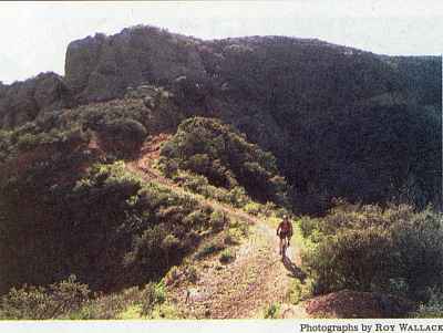
After several breaks and many sips of water you will reach the halfway point back up to the parking lot. Here you will notice a trail marker that reads Hermit Falls 1.2 miles. Take this trail for an added adventure and the reward will be a beautiful hike with views of the San Gabriel Mountains and soon a up close and personal look at the creek. Hermit Falls consists of a few pools and multi tiered waterfalls. This destination is popular amongst teenagers who use this as a swimming hole, Jumping from the rocks above into the 15+ft deep pools and sliding down Natures Waterslide.

  • 700 ft elevation gain/loss
  • 50 ft waterfall
  • difficulty- Easy on the way in – moderate on way out
  • season- All year
  • Adventure Pass required
  • 3.6 miles roundtrip
  • bring plenty of water

Click here for directions

This slideshow requires JavaScript.

Deer Season at Whiting Ranch

Tags

, , , , , , , , ,

image

We decided to take a short Monday morning hike out to the red rocks of Whiting Ranch. To our surprise we came across a number of deer. I was able to catch a couple with my phone’s video camera.

The Borrego Trail when combined with the Red Rocks Trail is a 5 mile hike round-trip (2.5 miles in 2.5 miles out). This is a great beginners hike and a hike that even the youngest family member can participate in.

Directions to Whiting Ranch (Borrego Trail)

Posted from WordPress for Android

BEDFORD PEAK

Tags

, , ,

Bedford Peak is part of the Santa Ana Mountains, home to Santiago Peak, the highest point in OC. Although Bedford Peak is not a major peak it is still a popular hike amongst locals.

Today we decided to conquer this trail and mark it off our list. Parking for this hike is located at The Maple Springs Trailhead, located in the town of Silverado.

From the parking lot you will continue on foot onto Maple Springs Rd for about .3 miles until you come across a sign that reads “Trail” This is the Silverado Trail (Silverado Motorway) make a left here and proceed past the yellow railing. Its all uphill from there!

The next 3 miles take you up 2,000 ft in elevation. Making for a very strenuous hike, especially on a warm day like today.( 80 degrees was the high) the trail starts of narrow and then widens out as you clear the brush. As you steadily climb in elevation the Santa Ana Mountains begin to reveal themselves and they are a beauty!

About half ways up the switchbacks, you reach coffin rock, here you are treated with wonderful views of OC, great place for photo opportunities!

Once you reach The Main Divide Rd. this is the indication that you are close to the peak. From here, hang a right past the white gate and continue up the trail for .1 miles or so until you reach Bedford Peak. (There is a brown rail about 2 ft high)

When you reach the peak, you can enjoy great views of Mt. San Jacinto, San Gorgonio, Mt. Baldy and OC in the distance.

-IF HIKING IN THE SUMMER, START EARLY! TRAIL IS FULLY EXPOSED! NO SHADE! BRING A HAT AND PLENTY OF WATER-

view of San Jacinto(right) and San Gorgonio (left)

view of San Jacinto(right) and San Gorgonio (left)

view of Mt. Baldy

view of Mt. Baldy

image

image

Taken on a much clearer day 2/14/13

• 6.6 miles round trip
• 2,000 ft elev. gain
• 3,800 ft summit
• Adventure pass required
• Strenuous

Happy Trails,
Alex G

EATON CANYON WATERFALL

Tags

, ,

Eaton Canyon is one of those places that is tucked away right beneath our noses. It is literally a few blocks from the freeway. Making it a great place for a quick day hike.

Eaton Canyon Waterfall is located in Pasadena, Ca and is a beautiful sight! Much like other waterfalls located in the San Gabriel Mountains. The waterfall itself is 50 ft with a large pool at its base. It is at the end of a 1.5 mile trail that begins at the parking lot of the Eaton Canyon Nature Center. Parking here is free of charge.

With a total Elevation gain of about 400 ft in 1.5 miles this hike is good for people of all ages. The first mile is on a dirt trail until you reach the Mt Wilson Toll Bridge. As u pass under the bridge you will soon notice the creek on the left hand side, there are a couple small pools here, this a great spot to take some pictures and enjoy the scenery.

The remainder .5 miles is in a narrow part of the canyon and consists of creek crossings and some rock scrambling so be careful on this last part.

There are a few side trails that branch off from the main trail. STAY ON THE MAIN TRAIL!!! Eaton Canyon has been the subject of multiple deaths this year News Link. the easiest way to get lost or seriously injured is by venturing off the main trail.

This is a popular hike so it does get crowded. Get there early if possible.

• 50 ft Waterfall
• 3 mile round trip
• Difficulty- Easy
• Free Parking
• 400 ft elevation gain
Click here for directions

Happy Trails,
Alex G

Petition to Save the Santiago Truck Trail

Tags

, , , , , , , , ,

image

The Santiago Truck Trail is at risk of being closed to the public. The County is contemplating purchasing the land from it’s current owners at a cost of $2.3 million. Please take the time to sign the petition and help preserve our open spaces. The Santiago Truck Trail leads up to The Luge (video), a popular single track mountain bike trail.

http://www.ipetitions.com/petition/savestt/

Posted from WordPress for Android

Dripping Cave / Cave Rock – Aliso and Wood Canyon Wilderness Park

Tags

, ,

cave entrance

cave entrance

This weeks hike was an easy hike with a big payoff!

The trail begins on a service road directly behind the Ranger Station. This is somewhat like the beginning of The Blackstar Canyon trail. After a short distance you pick up a single track trail, Aliso Canyon Trail, which will give you great views of the rolling hills and a hint of the geological wonders that lie within the park.

At the 1.5 mile mark you will reach a junction, go right, and proceed on Wood Canyon Trail. This trail is very popular with bikers so be aware of your surroundings because they come flying down the trail. Along the trail you will notice Cave Rock on your left. Save that trail for the way back! After .5 miles you will reach the junction with Dripping Cave trail go left for .5 miles until you reach the cave. The cave is none like I’ve seen in OC. It’s very large and appears to be next to a creek bed and is hidden behind a grove of trees. It’s no wonder why the Bandits used this as a hide out.

On our way back from Dripping Cave we decided to check out the Cave Rock Trail. Even though it was only .25 miles long it was one of my favorite parts of the hike. This trail has multiple caves and has wonderful views of the canyon. The trail meets back up with Wood Canyon Trail making for an easy return with an added bonus!
Click here for directions

cave rock trail

cave rock trail

cave rock trail

cave rock trail

cave rock trail

cave rock trail

• 5 miles round trip
• elevation gain 200ft
• caves
• Difficulty – Easy
• Time – 2.5 to 3 hours

Happy Trails,
Alex G

Mount San Jacinto Peak

Tags

, , ,

A view from the tram

A view from the tram

a view from 9700 ft

a view from 9700 ft

A view of Palm Springs from the peak

A view of Palm Springs from the peak

This fun and adventurous hike begins at the Palm Spring Aerial Tramway . After a 15 min ride full of stunning views, you will reach the upper station where the temperature is about 25 degrees cooler than down In the valley.

Once here you will make your way down to the main trail. After checking in at the Ranger Station you will proceed on the main trail, using the trail markers as reference. From the ranger station its 5.5 miles to the peak. Now 5.5 miles might not seem like much but hiking at high elevation is a lot tougher than hiking down in the valley. The air is thinner making it harder to breath. For me, this was my first time hiking above 9,000 feet. It took me a while to adjust to the altitude. I took breaks often to let my lungs adjust.

Most of the hike is through a beautiful forest with towering pines and amazing rock formations. Once you reach Wellmans Divide the trail changes from a dirt trail to a narrow rocky uphill battle to Wellmans Junction. At 9700 feet Wellmans Junction is a great place for a quick break and to snap a few pictures.

From here it is 2.3 miles to the peak and the most difficult part of the hike if you ask me but the views along the ridge are amazing

Once you reach the next trail marker you are almost there just .3 miles away.! First you will see the Emergency Shelter Cabin . This is a great place to stop by and visit. There is also a book for everyone to sign. Here, hikers have left emergency supplies, water and other items to assist other hikers who may be in need of help.

After exiting the shelter all that separates you from the best view of So. Cal is a quick rock scramble up to the peak. This is where you your hard work will be rewarded. the views from the peak are absolutely AMAZING! In the distance you can see Santiago Peak and San Gorgonio. It is definitely a hike that I will do over and over again.

• 10,834 ft above sea level
• Stunning Views
• 11 miles round trip
• 6 hours, 4 up 2 back + time spent at peak
• Elevation gain 2300 feet
• Difficulty- moderate / strenuous

Us and the clouds!

Us and the clouds!

Design a site like this with WordPress.com
Get started