• Easy Hikes
  • Moderate Hikes
  • Strenuous Hikes
  • Waterfalls
  • Outdoors
  • Distance hikes
  • Peaks
  • Caves
  • News
  • The 10 Essentials
  • Directions to our Favorite Trails

Your Favorite Hiker

~ Exploring SoCal and beyond!

Your Favorite Hiker

Category Archives: Strenuous Hikes

WEST HORSETHIEF – TRABUCO CANYON LOOP

09 Monday Jan 2012

Posted by Alex G in Cave, Distance hikes, Strenuous Hikes

≈ 2 Comments

Tags

cleveland national forest, Hiking, outdoors, Trabuco canyon trail, Trails, west horsethief

image

Trabuco trailhead

This is a wonderful 10.5 mile loop that begins at the Trabuco trailhead. To reach the trailhead you you have to travel about 5.5 miles up Trabuco Creek Rd. This parking lot is a mile or so past the Holy Jim parking lot and is a lot smaller. It only fits about 6 vehicles so arrive early.

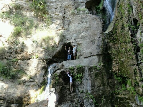
From the trailhead you will hike through a well shaded single track trail with a couple creek crossings, an old abandoned car and a sealed up mine. You will be on this trail for 1.7 miles until you reach the junction with the west horsethief trail.

image

abandoned car from the mining era

image

Sealed up mine

Once here you can go either straight or hang a right and the continue on the Trabuco Canyon trail. They both lead you up to the Main Divide Rd. The west horsethief trail is slightly harder since it is nothing but switchbacks and is fully exposed. The Trabuco trail partially exposed for the first mile or so then changes to a well shaded trail.

We took the easier route and took the Trabuco canyon trail. This trail offers great views of Santiago peak.

image

Santiago Peak from Trabuco Canyon Trail

The first part of this trail it fully exposed and can be a bit difficult but gets relatively easy once in the shade. About a mile before reaching the Main Divide Rd we came across a Christmas Tree that was decorated with ornaments apparently its a tradition amongst mountain bikers to decorate a tree during the holidays. This made for a great picture spot and a quick rest break.
image

Christmas Tree in the CNF

image

Pacific Ocean in the distance

Once you reach the main divide rd you will have a great view of Lake Elsinore.
image

Lake Elsinore

From here take the first left you will be on this trail for 2.5. On a clear day you will have great views of the 3 biggest peaks in So.Cal

image

Mt. Baldy, Mt. San Gorgonio, Mt. San Jacinto

After being on this trail for 2.5 miles you reach the West Horsethief Trail.
image

Trail is directly behind this post

This is a 2 mile trail that consists of nothing but switchbacks. It offers great views of Trabuco Canyon. From here it’s a total of 3.7 miles back to the parking lot.

This slideshow requires JavaScript.

Happy trails, Alex G. * HIGH CLEARANCE VEHICLE RECOMMENDED * • 10.5 mile loop • Creek crossing • sealed mine • Adventure pass required • 2,300 ft elevation change

Like this:

Like Loading...

SAN JUAN TRAIL

05 Thursday Jan 2012

Posted by Alex G in Distance hikes, Strenuous Hikes

≈ Leave a comment

Tags

CNF, Hiking, San Juan trail, Trails

I started this hike from the San Juan Trailhead located about 2 miles down Hot Spring Canyon Rd.

image

This hike is 11.6 miles one way. So to avoid a 23 mile round-trip hike we parked one car at the beginning and one at the San Juan Trailhead in the bluejay campground.
(This is where you will end your hike.)

Right off the back you are faced with 17-20 switchbacks (I lost count). The elevation gain is gradual so you will barely notice it. Soon you will be rewarded with great views.

This trail is popular with mountain bikers so be extra cautious as they sometimes come speeding down in the opposite direction.

image

There are a few connecting trails along this hike so remember to stay to the left at every junction. Look for the mile markers to make sure that you are on the right trail.

image

About 6 miles in you will reach the Los Pinos Potrero this is a flat meadow with lots of Oak trees. This is a great place to take a break and relax in the shade.

image

image

The remaining 5 miles are pretty shaded and make for a great hike out.

Happy Trails
Alex G.

image

• 11.6 miles one way
• Elevation change- 2600 ft
• Difficulty – moderate
• Forest adventure pass

Happy Trails,

Alex G
map of hike


This slideshow requires JavaScript.

Like this:

Like Loading...

LOS PINOS PEAK (via The Lazy W)

28 Wednesday Dec 2011

Posted by Alex G in Distance hikes, Peaks, Strenuous Hikes

≈ Leave a comment

Tags

bluejay campground, CNF, Los pinos, outdoors, peak

image

image

image

Los Pinos Peak (4,510 ft) is the 4th tallest peak of the Santa Ana Mountains and is located in the Cleveland National Forest.

The peak is accessible via the Los Pinos Trail and can be accessed from two points. One being via the Main Divide Rd, which is the easiest route to the peak. The 2nd is from the Los Pinos Trail via The Lazy W. This is the hardest route to reach the summit and is the way we decided to ascend the peak.

We parked one vehicle at the San Juan Trailhead which is in the back of Blue Jay Campground. We then carpooled to the other end of San Juan Trailhead which is located just before The Lazy W Methodist Camp. Before attempting this hike be sure to ask the camp for permission, being as the trailhead is on private property.

This is a tough hike! Only attempt it if you are ok with hiking long distances and are used to inclines as this trail is a combination of both. The hike was a total of 14 miles from one car to another. The elevation change from the base to the the peak is 3,300 ft but the total gain with all the”up and downs” is closer to 7,200 ft so be prepared!

On a clear day the hike along the ridge offers great views of the Pacific ocean, Catalina, San Jacinto, Baldy, San Gorgonio, Lake Elsinore and of course Santiago Peak.

The hike is along the ridge the whole time and it’s not very shaded. Be sure to bring a hat and sun block as you will be exposed to the sun the majority of the time.

Happy Trails,

Alex G

my map of the hike

image

• 4,510 ft peak

• 14 mile one way trail

• 3,300 elevation change

• Lots of “up and downs”

• 7 hours to complete

• Difficulty- Strenuous


This slideshow requires JavaScript.

Like this:

Like Loading...

THE BRIDGE TO NOWHERE

01 Thursday Dec 2011

Posted by Alex G in Moderate Hikes, Outdoors, Strenuous Hikes

≈ Leave a comment

Tags

Azusa, Bridge to nowhere, east fork, Hiking, rappelling, San Gabriel Mountains, San Gabriel River

The Bridge to Nowhere

Earlier this year our hiking group decided to tackle the Bridge to nowhere hike. We had no idea what we were getting ourselves into.

We started our hike early in the morning seeing as this is 10 mile hike we wanted to get as much sunlight in as possible. The drive in was amazing. After leaving the city behind you find yourself driving along the San Gabriel Dam/Reservoir and soon after that you’ll be driving along the San Gabriel River. Beautiful views the whole way in!

Once you reach the parking lot, place your forest adventure pass on your dash and gear up for an amazing,challenging and one of a kind hike.

Not even 10 minutes into the hike and we were already faced with a river crossing. This was our first hike that involved river crossings. Prior to this we had only had to cross small creeks and streams, so this was definitely a shocker to see the raging river. Due to the heavy rains in the earlier months the river was still roaring in May.  We cautiously crossed the river in groups of 2 and 3 and walked against the current in knee-high water. Success! Everyone in our group of 16 made it across the first crossing. Just 5 more to go! Yes, that’s right, this 10 mile hike has a total of 6 river crossings, so be prepared!

The easiest way for us was to stay to the right of the river as much as possible and crossing the river when we ran out of land. The scenery is nice and the sounds of the water make for a great hike. After a few river crossings you get to point where you have gained some elevation and soon after that the trail comes to an end.. Not to fear, this is where you will get a self taught lesson on rappelling. That is right, there is a rope anchored into the rock-face that assists you as you guide yourself down the cliff-side. It sounds difficult but was pretty easy.

Now that the hard part is out of the way from here its a relativity easy hike to the Bridge. One of the first things you will notice is  people bungee jumping from the bridge. I believe reservations are required and can be made at Bungee America. Once here you can find a spot near the bridge to have a snack or lunch or you can follow the trail down to river to cool down or do some further exploring.

Return the way you came and always use caution, especially when crossing the river.

This was definitely one of my favorite hikes and I can’t wait to do it again!

Happy Trails,

Alex G.

FOR DIRECTIONS Google Maps Link to Trailhead 

  • 10 miles 5 in/5 out
  • hiking time- 5 hours
  • elevation gain- 1000ft.
  • difficulty- moderate/difficult(river crossings)
  • adventure pass
  • sunblock-
  • start early to beat the heat

This slideshow requires JavaScript.

Like this:

Like Loading...

STURTEVANT FALLS / HERMIT FALLS

05 Wednesday Oct 2011

Posted by Alex G in Moderate Hikes, Outdoors, Strenuous Hikes, Waterfalls

≈ Leave a comment

Tags

Creek, Hiking, rock pools, waterfall

Sturtevant Falls is located in the San Gabriel Mountains and is accessible via the Chantry Flats Recreational Area. This is one of my favorite waterfalls for many reasons. One being that is is so easy to get to, this is a great hike for kids and adults. Another reason is the 50 ft waterfall that awaits you at the end of a 1.8 mile hike. Now you’re thinking 1.8 miles is not that bad…but there’s a catch.

The adventure begins in the parking lot which opens at 6am, and gets full really quick! Once you’ve found parking and displayed you’re Forest Adventure pass on you’re dashboard you are good to go.

Look for the sign that reads Sturtevant Falls and proceed past it to the trail that leads down into the canyon. Follow the fire road all the way down. Soon you will be hiking on a dirt trail with the sounds of the creek flowing in the background. The trail becomes very jungle like and before you know it you are walking along a cabin lined trail with the tree canopy providing shade on those warm summer months. There are a few tricky creek crossings along the way so be careful. If in doubt  just walk through the water…after all, its just water.

You will know when you are near, as the sounds of the gushing waterfall gets louder with every step. When you finally reach the waterfall you will be amazed at the size and how easy it was to reach it.

When I first did this hike earlier in the year i couldn’t believe how easy it was to reach such a natural wonder. I took some pictures and videos and had a snack enjoying the sights and sounds of Sturtevant Falls… Then I geared up and began to head out with the rest of the group. This is where the i realized that this easy hike was to good to be true. The hard part begins as soon you leave the dirt trail behind and pick up the fire road. This is about a 700 ft elevation gain in about .6 miles! On a cool day this isn’t too bad but on those hot summer days I recommend getting an early start.

After several breaks and many sips of water you will reach the halfway point back up to the parking lot. Here you will notice a trail marker that reads Hermit Falls 1.2 miles. Take this trail for an added adventure and the reward will be a beautiful hike with views of the San Gabriel Mountains and soon a up close and personal look at the creek. Hermit Falls consists of a few pools and multi tiered waterfalls. This destination is popular amongst teenagers who use this as a swimming hole, Jumping from the rocks above into the 15+ft deep pools and sliding down Natures Waterslide.

  • 700 ft elevation gain/loss
  • 50 ft waterfall
  • difficulty- Easy on the way in – moderate on way out
  • season- All year
  • Adventure Pass required
  • 3.6 miles roundtrip
  • bring plenty of water

Click here for directions

This slideshow requires JavaScript.

Like this:

Like Loading...

BEDFORD PEAK

24 Saturday Sep 2011

Posted by Alex G in Peaks, Strenuous Hikes

≈ 1 Comment

Tags

cleveland national forest, maple springs, santa ana mountains, summit

Bedford Peak is part of the Santa Ana Mountains, home to Santiago Peak, the highest point in OC. Although Bedford Peak is not a major peak it is still a popular hike amongst locals.

Today we decided to conquer this trail and mark it off our list. Parking for this hike is located at The Maple Springs Trailhead, located in the town of Silverado.

From the parking lot you will continue on foot onto Maple Springs Rd for about .3 miles until you come across a sign that reads “Trail” This is the Silverado Trail (Silverado Motorway) make a left here and proceed past the yellow railing. Its all uphill from there!

The next 3 miles take you up 2,000 ft in elevation. Making for a very strenuous hike, especially on a warm day like today.( 80 degrees was the high) the trail starts of narrow and then widens out as you clear the brush. As you steadily climb in elevation the Santa Ana Mountains begin to reveal themselves and they are a beauty!

About half ways up the switchbacks, you reach coffin rock, here you are treated with wonderful views of OC, great place for photo opportunities!

Once you reach The Main Divide Rd. this is the indication that you are close to the peak. From here, hang a right past the white gate and continue up the trail for .1 miles or so until you reach Bedford Peak. (There is a brown rail about 2 ft high)

When you reach the peak, you can enjoy great views of Mt. San Jacinto, San Gorgonio, Mt. Baldy and OC in the distance.

-IF HIKING IN THE SUMMER, START EARLY! TRAIL IS FULLY EXPOSED! NO SHADE! BRING A HAT AND PLENTY OF WATER-

view of San Jacinto(right) and San Gorgonio (left)

view of San Jacinto(right) and San Gorgonio (left)

view of Mt. Baldy

view of Mt. Baldy

image

image

Taken on a much clearer day 2/14/13

• 6.6 miles round trip
• 2,000 ft elev. gain
• 3,800 ft summit
• Adventure pass required
• Strenuous

Happy Trails,
Alex G

Like this:

Like Loading...

Mount San Jacinto Peak

05 Monday Sep 2011

Posted by Alex G in Distance hikes, Peaks, Strenuous Hikes

≈ 3 Comments

Tags

Hiking, mountain, San Jacinto Peak, Trails

A view from the tram

A view from the tram

a view from 9700 ft

a view from 9700 ft

A view of Palm Springs from the peak

A view of Palm Springs from the peak

This fun and adventurous hike begins at the Palm Spring Aerial Tramway . After a 15 min ride full of stunning views, you will reach the upper station where the temperature is about 25 degrees cooler than down In the valley.

Once here you will make your way down to the main trail. After checking in at the Ranger Station you will proceed on the main trail, using the trail markers as reference. From the ranger station its 5.5 miles to the peak. Now 5.5 miles might not seem like much but hiking at high elevation is a lot tougher than hiking down in the valley. The air is thinner making it harder to breath. For me, this was my first time hiking above 9,000 feet. It took me a while to adjust to the altitude. I took breaks often to let my lungs adjust.

Most of the hike is through a beautiful forest with towering pines and amazing rock formations. Once you reach Wellmans Divide the trail changes from a dirt trail to a narrow rocky uphill battle to Wellmans Junction. At 9700 feet Wellmans Junction is a great place for a quick break and to snap a few pictures.

From here it is 2.3 miles to the peak and the most difficult part of the hike if you ask me but the views along the ridge are amazing

Once you reach the next trail marker you are almost there just .3 miles away.! First you will see the Emergency Shelter Cabin . This is a great place to stop by and visit. There is also a book for everyone to sign. Here, hikers have left emergency supplies, water and other items to assist other hikers who may be in need of help.

After exiting the shelter all that separates you from the best view of So. Cal is a quick rock scramble up to the peak. This is where you your hard work will be rewarded. the views from the peak are absolutely AMAZING! In the distance you can see Santiago Peak and San Gorgonio. It is definitely a hike that I will do over and over again.

• 10,834 ft above sea level
• Stunning Views
• 11 miles round trip
• 6 hours, 4 up 2 back + time spent at peak
• Elevation gain 2300 feet
• Difficulty- moderate / strenuous

Us and the clouds!

Us and the clouds!

Like this:

Like Loading...

MARY JANE FALLS

26 Friday Aug 2011

Posted by Alex G in Cave, Outdoors, Strenuous Hikes, Waterfalls

≈ 3 Comments

Tags

cave, forest, Hiking, Las Vegas, mt. Charleston, Nevada, spring mountains, waterfall

Mary Jane Falls… WOW!
This is probably the best hike I’ve been on so far for one reason and one reason only, the location!

Located 40 minutes north of the Las Vegas Strip there is a hidden paradise. A place that is overshadowed by the towering hotels and casinos. This amazing oasis is located in the Spring Mountains of southern Nevada.

This isolated adventure begins way before you reach the Mary Jane Falls Trailhead. As you leave the city in your rear view you will soon be driving down a one lane highway with amazing rockscape on either side. The scenery changes drastically in a matter of seconds. You will find yourself driving along a pine and campground filled highway (reminded me of the San Bernardino national Forest)

Now this is where the fun begins. Once you have parked you will notice the trailhead sign and the trail directly behind it. The first 1/3 mile is at a slight incline along a rocky trail. you will soon reach a sign that reads “trail” at the base of the switchbacks. (At this point I took some time to let my lungs adjust to the elevation before continuing) on the trail up the switchbacks you will see towering Ponderosa Pines, White fur and Aspen trees in the canyon below.

As you reach the top of the switchbacks you have an amazing view of Kyle Canyon and the canyon walls and you suddenly realize that you are 9,000+ ft above sea level. Such and amazing feeling.

When you reach the falls you will be in awe at the height of these natural wonders. The view is amazing! There are 2 caves, 3 waterfalls and a view of Big Falls, which is across the canyon.

I can’t wait till my next trip to Vegas. This is a must do hike. It is great for kids, dogs and adults.

The best part of this hike is that the temperature is 20-25 degrees cooler than in the LV valley. Excellent for hiking in the summer.

Happy Trails,
Alex G

•Waterfall
•1000 ft elevation gain
•Cave
•3 miles round trip
•free parking

Like this:

Like Loading...

HARDING CANYON WATERFALL

20 Saturday Aug 2011

Posted by Alex G in Outdoors, Strenuous Hikes, Waterfalls

≈ 8 Comments

Tags

Creek, pools, waterfall

In March of 2011 our sense of adventure led us to Modjeska Canyon, Ca for an attempt to reach Harding Canyon Waterfall.

We geared up and headed towards the Santa Ana Mountains to reach the trailhead before sunrise. Parking for Harding Canyon Falls is located at the Tucker Wildlife Sanctuary Parking here is free but limited, so arrive early for a spot.

The trail begins to the right of the sanctuary on Harding Truck Trail. After a .25 mile walk at a slight incline you reach a fork in the road. From here go left and you will soon reach the creek bed. Head to your right until you reach the creek. Now here is where the fun part begins.

By no means is this an easy hike so be prepared for a long and wet hike.

Head up creek for 3 1/2 hours… Yes that’s right 3 1/2 hours. On this adventure you will hike along the creek, in the creek and across the creek. Staying dry is not an option. You will see some of the best creek pools around! (Great for the summer months) The trail is very shaded and sprawling with plant life including the infamous Poison Oak, so be aware of your surroundings. Newts lizards frogs and snakes are also common along the trail so keep an eye out.

After several creek crossings the canyon begins to narrow and the boulders begin to appear. Continue on up creek for the waterfall is just around the way. (that’s what I kept telling myself)

After a long, challenging, wet hike you should now be embracing the sight of Harding Canyons hidden beauty. A beautiful 40 ft waterfall with a waist deep pool at its base.

Although very difficult it is still very doable. As always be prepared and use common sense.

Click here for directions

•waterfall
•creek
•pools
•8 miles r/t
•3 1/2 hrs one way
•free but limited parking

Like this:

Like Loading...

Blackstar Canyon Waterfall

18 Thursday Aug 2011

Posted by octrailhikers in Cave, Outdoors, Strenuous Hikes, Waterfalls

≈ 1 Comment

Tags

blackstar, canyon, cave, county, Creek, Hiking, irvine, oc, orange, salamander, waterfall

image

image

image

image

     If you have grown up in OC, chances are that you have heard the stories surrounding Blackstar Canyon. These stories range from hauntings to cult sacrifices to murderous  squatters. While I’m not willing to confirm or deny the validity of any of these tales, I can tell you that there is indeed a pretty spectacular waterfall hidden here.
     Most hikers that venture into Blackstar Canyon never make it quite far enough into the canyon to find the waterfall trail. Those that do make it in are likely to pass right by the shrub covered creek entrance. From the parking area the creek entrance is 2.5 miles along a relatively flat fire road, and you can find it as long as you know what to look for. You will easily spot a couple of large concrete tubes at the point where the trail begins to climb. Directly to the right of these cylinders you will spot a small clearance in the brush that is bordering the trail. This is the entrance down into the creek.
     The creek  portion of the hike provides some pretty challenging boulder climbing which is obviously most difficult in the winter and spring months due to the rain. The trek through the creek is an additional 2.5 miles, but plan on it feeling more like 4 miles when you factor in all of the climbing. Be sure to pack plenty of water and some light snacks. A first aid kit would also be a wise choice. This trail is covered in poison oak and I have witnessed a pretty nasty cut resulting in 14 stitches as well as someone taking a tumble from the cave that is alongside the waterfall.
     This is one of the more challenging trails that I have experienced in OC, but I would say that the payoff is well worth it. The Blackstar Canyon Waterfall is a spectacular site especially in the rainy season, and it is still very impressive in the dry season when the water is but a trickle. When you first lay eyes upon it I’m sure you’ll be just as surprised as I was that such a thing exists right in our own backyard.

-FPMiv
    

Posted from WordPress for Android

Like this:

Like Loading...
← Older posts
Newer posts →

Blog Stats

  • 119,577 views

Top Posts & Pages

  • HAGADOR CANYON
  • Tin Mine Canyon (Corona, CA)
  • SAN MATEO PEAK
  • MOUNT BALDY (via Old Baldy Trail)
  • THE BRIDGE TO NOWHERE

Enter your email address to follow this blog and receive notifications of new posts by email.

Join 401 other subscribers

Advertisement

Archive

Blog at WordPress.com.

Privacy & Cookies: This site uses cookies. By continuing to use this website, you agree to their use.
To find out more, including how to control cookies, see here: Cookie Policy
  • Follow Following
    • Your Favorite Hiker
    • Join 61 other followers
    • Already have a WordPress.com account? Log in now.
    • Your Favorite Hiker
    • Customize
    • Follow Following
    • Sign up
    • Log in
    • Report this content
    • View site in Reader
    • Manage subscriptions
    • Collapse this bar
 

Loading Comments...
 

    %d bloggers like this: