• Easy Hikes
  • Moderate Hikes
  • Strenuous Hikes
  • Waterfalls
  • Outdoors
  • Distance hikes
  • Peaks
  • Caves
  • News
  • The 10 Essentials
  • Directions to our Favorite Trails

Your Favorite Hiker

~ Exploring SoCal and beyond!

Your Favorite Hiker

Tag Archives: climbing

MOUNT BALDY (via Old Baldy Trail)

10 Thursday May 2012

Posted by Alex G in Distance hikes, Outdoors, Peaks, Strenuous Hikes

≈ 8 Comments

Tags

california, climbing, hike, Hiking, hiking group, los angeles, mount baldy, mountain, mountain range, Mt. Baldy, peak, san antonio peak, San Gabriels, snow, summit, trail, Trails, views

Plaque on the top of Baldy

This past April our group decided to hike up to the summit of Mount Baldy (officially Mt. San Antonio).  There are 4 ways to reach the peak. With Mt. Whitney just a few months away, we decided to challenge ourselves and take the Old Baldy Trail which is 6.4 miles long and has a gain of about 5,800 ft making it a very challenging and difficult hike.

The parking lot for this hike is located right next to the Mt. Baldy Village Church. A forest adventure pass is required.

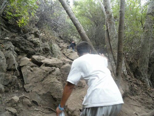
After a quick bag check we started up Bear Canyon Rd for about .4 miles to the trailhead.

Trailhead at the end of Bear Canyon Rd

After enjoying the the sounds of the creek and sights of the cabins for .4 miles we left the paved road behind and continued on the dirt single-track trail that is Old Mt Baldy Trail. Our next destination was Bear Flat (1.8miles) here we regrouped and took a short break before continuing on for the remaining 4.6 miles.

The First 1.8 miles are the easiest…

The rest of the hike has a gain of 900 feet per mile making it very difficult.  As soon as you leave Bear Flat you start to switchback up the south side of the mountain leaving you exposed to the sun , so bring a hat and pack on the sunblock! Views of Ontario Peak are all you can see from here.

Ontario Peak

After about 2 miles we hit the end of the switchbacks and continued up the ridge. This is where SoCal began to reveal itself.

getting higher and higher.. The Santa Ana Mountains are starting to reveal themselves!

If you make it here.. Just keep on going as the hardest part is now over. My favorite part of this hike(other than reaching the peak) was when we I reached the Narrows Ridge This was an Amazing experience with awesome views!

My Wife making her way up Narrows Ridge

View of Mt Baldy from Narrows Ridge

When we reached the top of the ridge my jaw dropped!

Jaw is Dropped! top of the Narrows Ridge

Up until here we were on a dirt trail which was easy to follow and easy to walk on.. This was a first for me.. hiking in the snow.. it sounds nice in ones head but the fact of the matter is this stuff was slushy and knee deep in some places.. With Baldy in our sights we had no choice but to fuel up and keep on trekking!

Once we hit the saddle between West Baldy and Baldy we had a choice to visit WB but we were just too drained, so we continued to the right and made the final push up to Baldy!

WE MADE IT!!!!

My krew and I on the highest peak in LA

Happy Trails,
Alex G.

This slideshow requires JavaScript.

  • 12.8 round-trip
  • 6.4 miles to the top
  • 900 ft of gain per mile
  • 5,800 ft of gain
  • 10,834 ft peak
  • Tallest peak in LA
  • 3rd tallest peak in So Cal
  • adventure pass required
  • Difficulty– Very Strenuous
  • start early to beat the heat 6 or 7am
  • total hike time 7-11 hours depending on pace

Like this:

Like Loading...

Escondido Canyon Waterfall

24 Wednesday Aug 2011

Posted by octrailhikers in Easy Hikes, Outdoors, Waterfalls

≈ Leave a comment

Tags

bats, boulders, caves, climbing, Creek, escondido canyon, Hiking, Malibu, OC Trail Hikers, ropes, santa monica mountains, waterfall

image

image

image

image


     Escondido Falls is a great trail to hike anytime of year. This trail is located in the Santa Monica Mountains of Malbu. The proximity to the coast provides relief from the heat of the SoCal Summer. The temperature here usually lingers in the mid to upper 60’s. The only drawback to hiking this close to the exclusive sands of Baywatch Beach would be the very limited parking. You will definitely want to arrive early.The tiny parking lot is located at Winding Way and PCH.There are no parking fees.
     The trailhead is about 1/2 a mile north on Winding Way from the parking lot. Winding Way is basically a private road leading to some pretty swanky homes. The entire hike ends up being about 4.2 miles roundtrip. I would say that it is a pretty family friendly trail as long as your children are at least 6 years of age. Poison oak is abundant here. You will want to keep everyone on the trail. There is some bouldering involved and there is a pretty steep portion of trail where you may choose to use a rope that someone has setup to aid you in your climb.
    There are a couple of small waterfalls along the first portion of the trail, but it is the last waterfall that you will really want to see. The last waterfall is a multi-tiered beauty with a total height of roughly 150 feet. It isn’t your typical California waterfall. This one is covered in moss and grass and is definitely this most tropical looking waterfall that we have experienced (YouTube Link).

-FPMiv

Like this:

Like Loading...

Blog Stats

  • 119,167 views

Top Posts & Pages

  • BLACK STAR CANYON INDIAN VILLAGE
  • HARDING CANYON WATERFALL
  • HAGADOR CANYON
  • EATON CANYON WATERFALL
  • Quail Mounatin
  • LIMESTONE CANYON LOOP

Enter your email address to follow this blog and receive notifications of new posts by email.

Join 401 other subscribers

Advertisement

Archive

Blog at WordPress.com.

Privacy & Cookies: This site uses cookies. By continuing to use this website, you agree to their use.
To find out more, including how to control cookies, see here: Cookie Policy
  • Follow Following
    • Your Favorite Hiker
    • Join 61 other followers
    • Already have a WordPress.com account? Log in now.
    • Your Favorite Hiker
    • Customize
    • Follow Following
    • Sign up
    • Log in
    • Report this content
    • View site in Reader
    • Manage subscriptions
    • Collapse this bar
 

Loading Comments...
 

    %d bloggers like this: